
Home


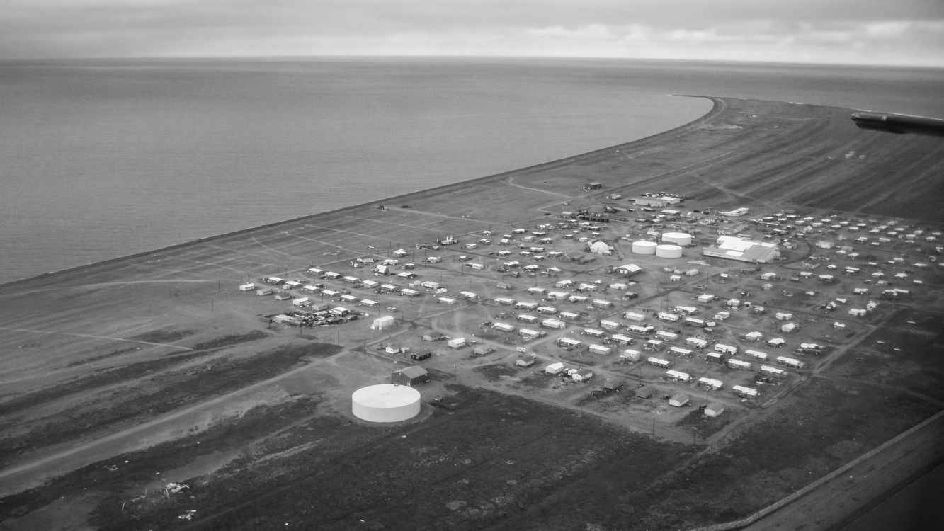
Modern-day Point Hope is located on a narrow peninsula hooking into the Chukchi Sea. In the not-so-distant past, the village was further out on the peninsula, but erosion caused by an encroaching sea has wiped away a good bit of the peninsula, and the old village, called Tikigaq (which means index finger – for the peninsula’s shape), was relocated further inland due to seawater inundation. With evidence of habitation going back at least nine thousand years, Tikigaq Peninsula is regarded as one of the very oldest continuously inhabited sites in North America.
The very essence of an Alaskan bush village is its isolation and remoteness. The only road leading out of Point Hope, Seven Mile Road, ends abruptly a good bit less then seven miles: 250 miles from Barrow, 572 miles to Fairbanks, 694 miles from Anchorage. Thus Point Hope exists as a neatly lain out grid of homes and other buildings surrounded on two sides by water and on one by the vast Arctic tundra. Polar Bears and Arctic Foxes are regular visitors. To experience life in a place so thoroughly separated from the rest of the world is perspective changing – and in an unexpected way, exhilarating.
Large ocean-going barges freight in everything from the school bus – which keeps children safe from both frostbite and Polar Bears – to heavy equipment and building supplies; planes bring in smaller items, including groceries and mail. Hunting and gathering provide a great deal of additional food. This subsistence take includes Bowhead and Beluga whale meat and blubber, caribou, ducks, geese, ptarmigan, salmon, char and grayling along with cloudberries (Rubus chamaemorus) a few blueberries and in some families, seaweeds.
Photographs in coming days will show more of the village and perhaps lend some insight into life there. Thanks for reading.
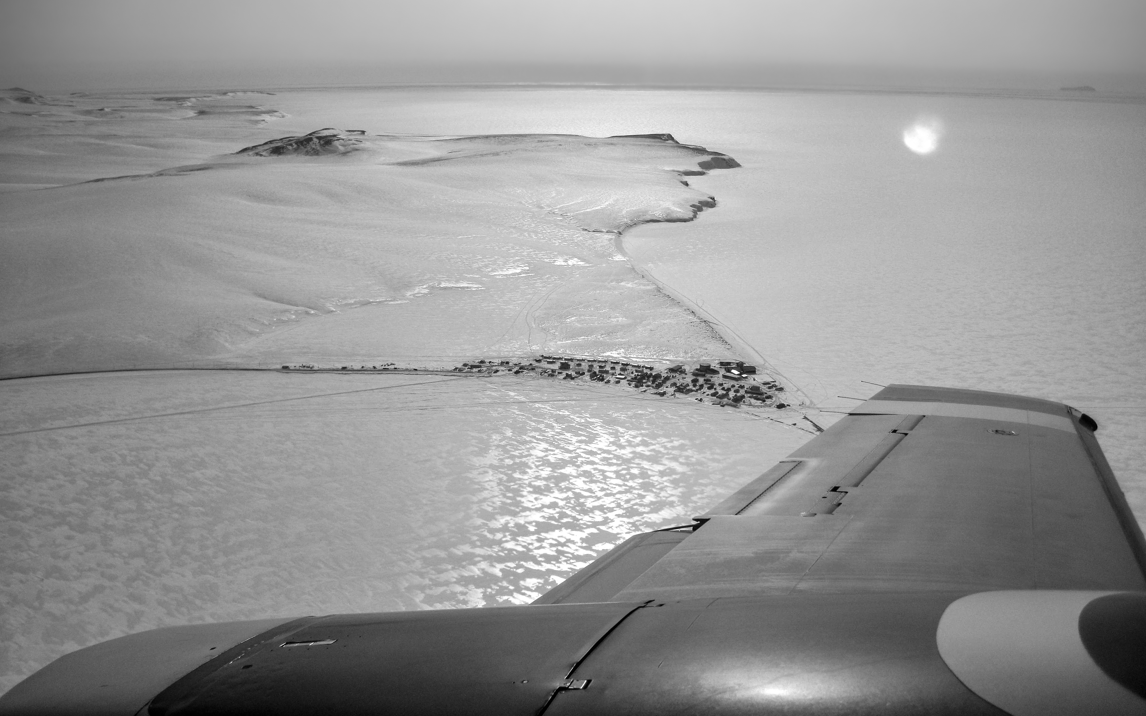
Flying into the village of Shishmaref for the first time was an unforgettable thrill. This wintertime photograph, in which the barrier island upon which Shishmaref is located appears to be connected to land, belies the village’s isolation. That is ice, not terra firma, surrounding Sarichef Island which encompasses only 2.8 square miles and rises no higher than 13 feet above the surrounding sea. The village itself is home to fewer than 600 mostly Inupiat residents. Tucked up against the ever encroaching Chukchi Sea, Shishmaref lies a mere 20 miles below the Arctic Circle, 105 miles from the Siberian coastline across the Bering Strait, 601 miles from Anchorage and 2,939 miles from L.A. The wintertime winds, with a fetch of perhaps thousands of miles across frozen northern seas, blew at times with terrifying ferocity and cold, on one memorable occasion all but burying the village in snow.
In the next few photos to come, I will try to show a bit about life in this remote village which is perhaps best known as being on the vanguard of the impacts of climate warming, but where also there is beautifully crafted artwork and a spirit of resilience. As always, your comments are welcome.
