
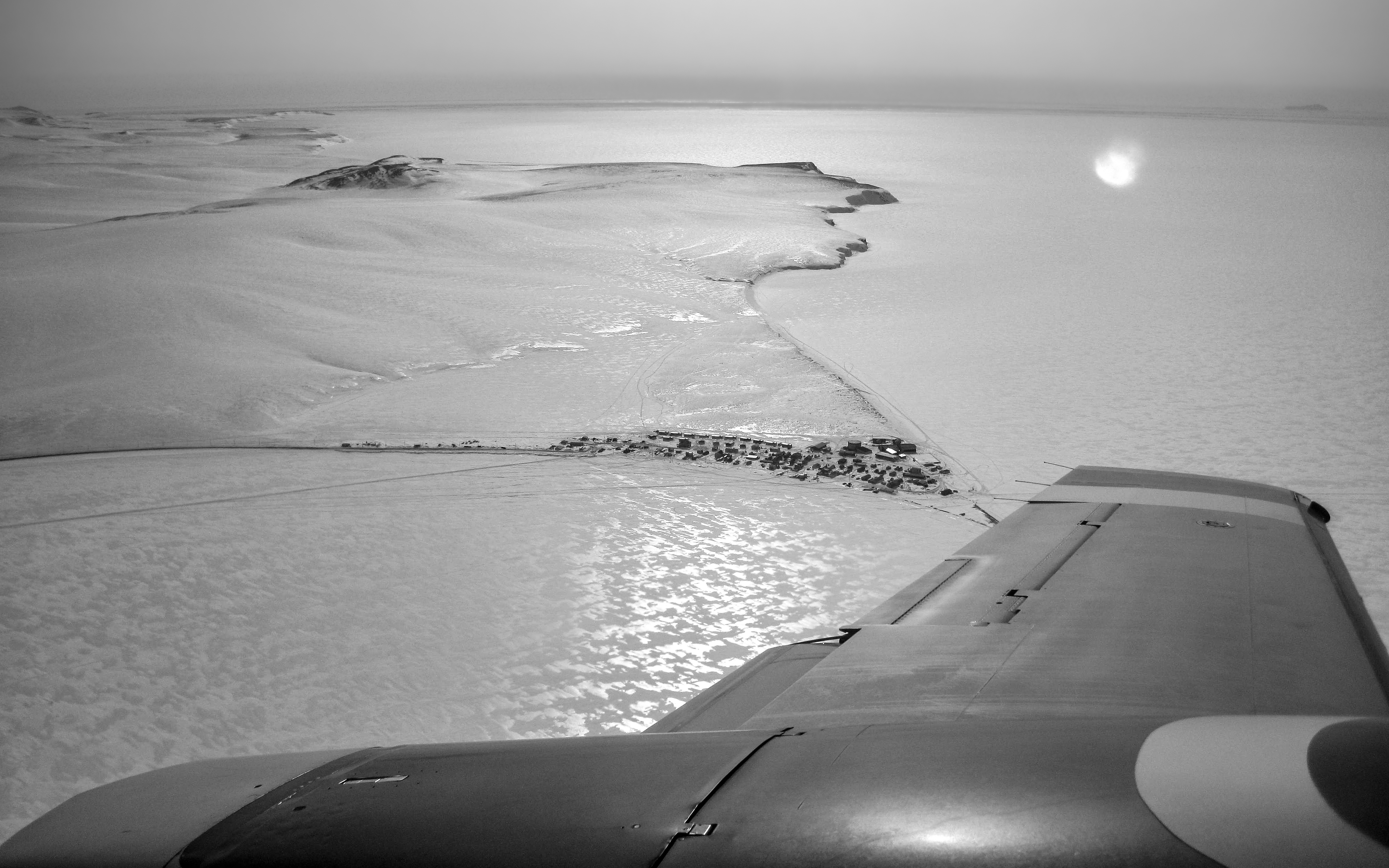
Flying into the village of Shishmaref for the first time was an unforgettable thrill. This wintertime photograph, in which the barrier island upon which Shishmaref is located appears to be connected to land, belies the village’s isolation. That is ice, not terra firma, surrounding Sarichef Island which encompasses only 2.8 square miles and rises no higher than 13 feet above the surrounding sea. The village itself is home to fewer than 600 mostly Inupiat residents. Tucked up against the ever encroaching Chukchi Sea, Shishmaref lies a mere 20 miles below the Arctic Circle, 105 miles from the Siberian coastline across the Bering Strait, 601 miles from Anchorage and 2,939 miles from L.A. The wintertime winds, with a fetch of perhaps thousands of miles across frozen northern seas, blew at times with terrifying ferocity and cold, on one memorable occasion all but burying the village in snow.
In the next few photos to come, I will try to show a bit about life in this remote village which is perhaps best known as being on the vanguard of the impacts of climate warming, but where also there is beautifully crafted artwork and a spirit of resilience. As always, your comments are welcome.

Your first Memory of living and teaching in Alaska?
Yes, Flying into Shishmaref.
Wonder if you have taken photos of The Land of Ten Thousand Smokes in Katmai National Park.I flew over it on my way back from the Pribs at the end of crab season.Never forgot that glorious moonscape!
We’ve never flown over that part of Alaska. It does look surreal.