When we first came to Alaska back in 2009, you could still make the 49 mile drive from Cordova to the Million Dollar Bridge (the Bridge to Nowhere). Across the broad, swift, roily Copper River, massive Childs Glacier towered. We had just completed the Salmon Jam half-marathon. Along with another couple, we rented a car and made the drive out through the vast delta wetlands along a mostly unpaved rough, pot-holed road – Trumpeter Swans, other waterfowl, beaver lodges, bear scat and even a couple of moose along the way, distant mountains, our eyes wide with Alaska wow.
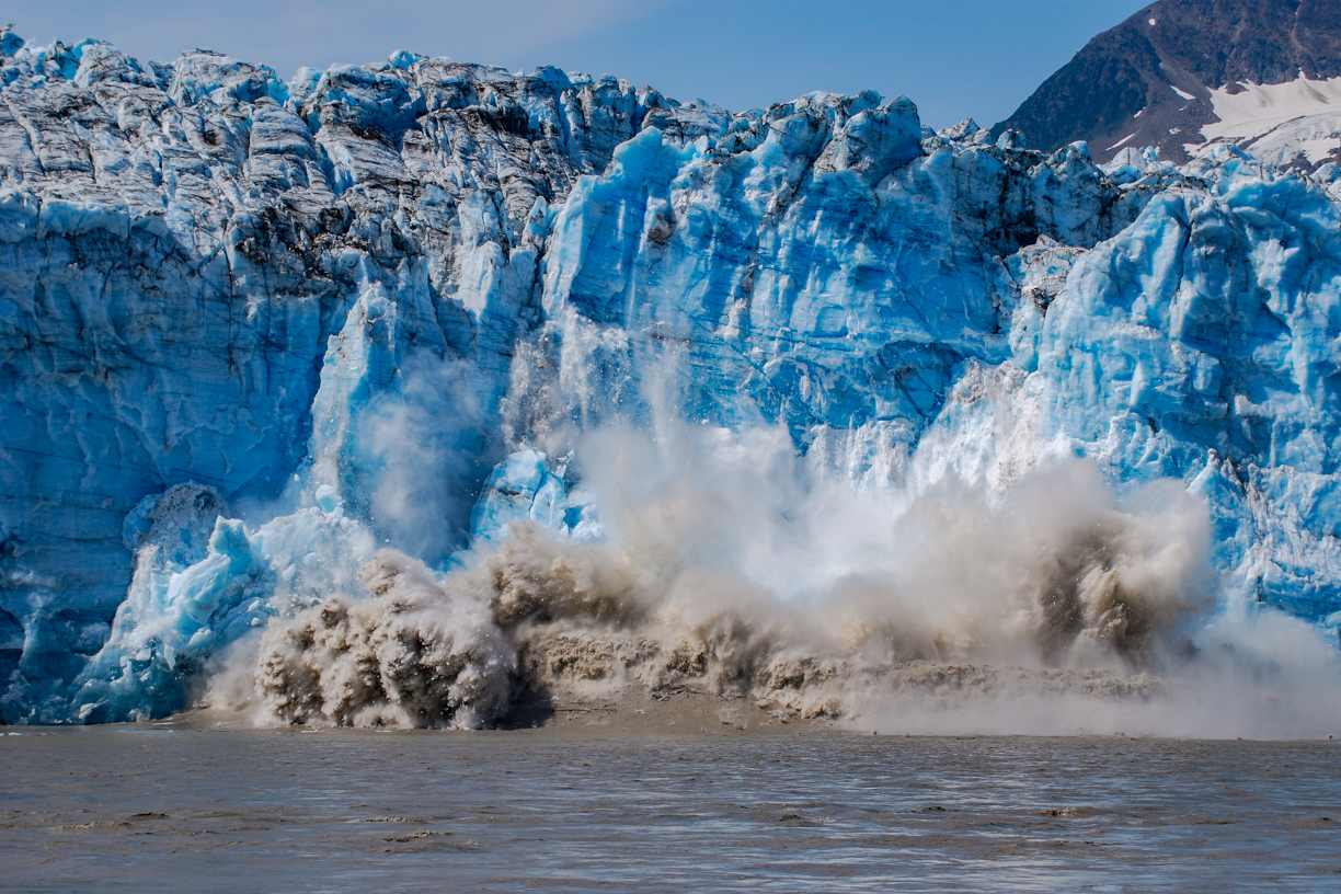
Barbra was our primary photographer in those days. We had identified an area that was active, popping and cracking, sloughing off showers of ice. “That entire face is going to go,” I predicted. Barbra set up the camera on a tripod and programmed it to take a shot every second. (The result was like a stop action film.) Shortly after the above shot was made, a wave of five or six feet came barreling toward us with a speed that caught us off guard. I grabbed the tripod as we scrambled for higher ground. Back in Cordova, upon seeing the photos on our camera a Forest Service Ranger told us we had witnessed a “once in every five years or so event.”
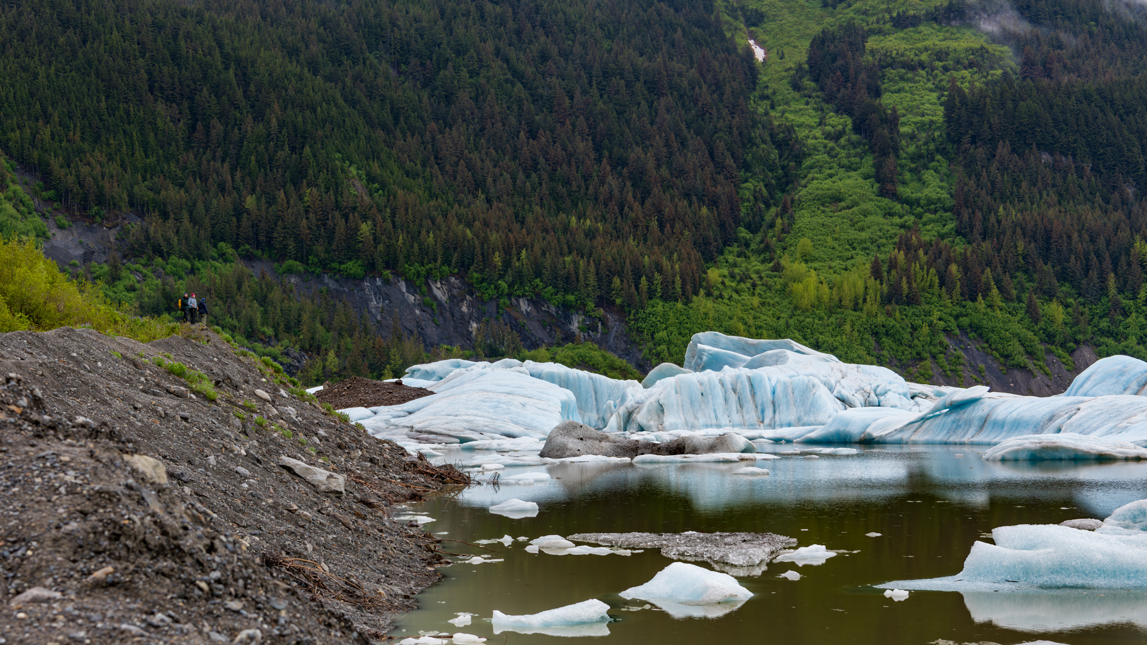
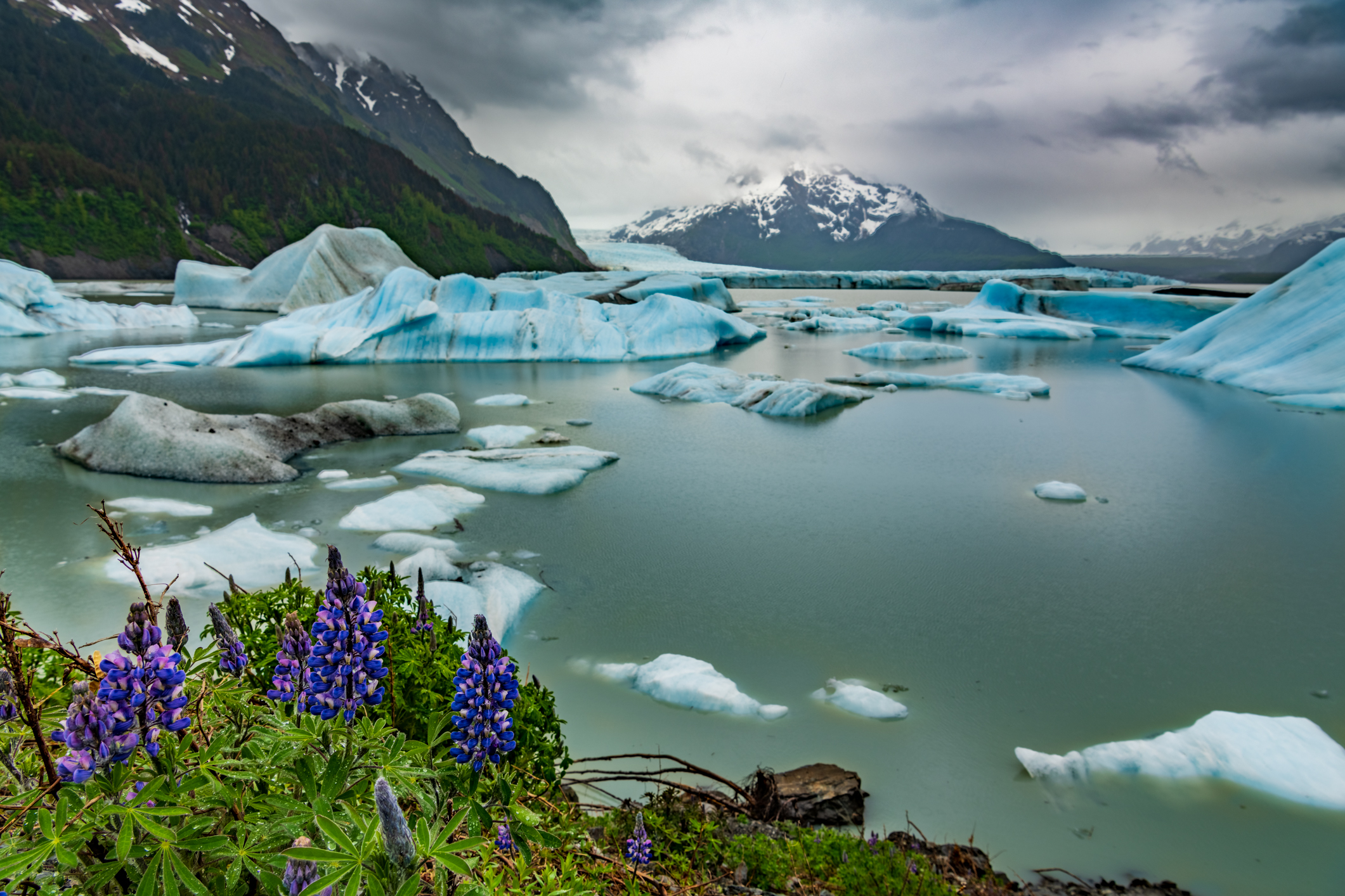
Quite a few of the images I capture are key-worded “vast” in my Lightroom catalog. Here, as I was walking along the glacial moraine at Sheridan Lake, I turned around just in time to catch Barbra and two visiting friends taking in the landscape. Located about 17 miles from our home in Cordova, a short walk through spruce and hemlock forests leads to this magical lake where, in wintertime people ice skate among massive structures of ice and in springtime and early summer kayak and canoe through the same setting.
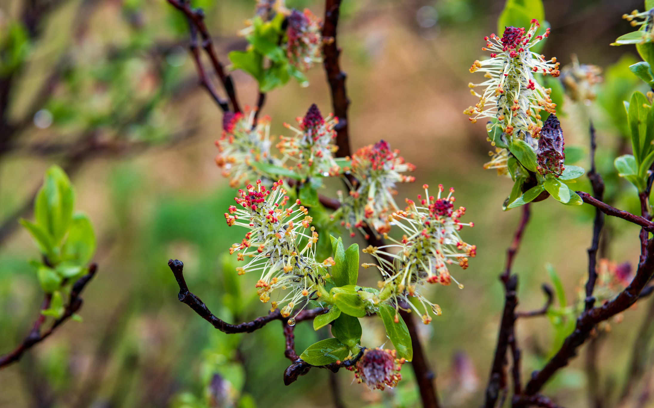
It was June 12 when we visited the lake, but here on the edge of Alaska’s Chugach National Forest, the world’s northernmost rainforest, it’s still spring as these willow flowers attest.
That’s Sheridan Mountain on the left side of this image – another hike for another day. Just right of center is a peek view of Sheridan Glacier itself.
We’re hoping to visit this lake again soon with our pack rafts, hopefully on a day with a little nicer light. It’d be interesting to get a closer view of the ice, and to put a watercraft of known size in the picture to provide a sense of scale.
Having arrived in Cordova by ferry from Whittier (a 100-mile cruise across Prince William Sound) on May 15, although most of our time has been given to setting up our new home, we’ve already managed to feather in a handful of hikes. With nearly 20 named Forest Service trails within a short drive – and all of them changing with the seasons, all of them beautiful as they wind through stands of moss-draped evergreens, through muskeg, up mountains and along lakes, rivers and streams, there will be lots more to come. So stay tuned!
A landscape seen by fewer than 100 living people….
The Hike Up Flattop
There’s a small mountain behind our village. We call it Flattop, though once you reach the peak you find that it is somewhat rounded. Although reaching the summit constitutes an elevation gain of only about 1,200 feet (a quarter of a mile; four football fields), because it is the foreword-most mountain facing the village, the summit provides an unobstructed 180 degree view sweeping from the corner of Chignik Lake to one’s left where Clarks River enters, down the lake and through the village, and then down the Chignik River all the way across the estuary to the next village, Chignik Lagoon, a vista encompassing about 12 miles. But in fact, the view is more grand even than that, for one can see mountains 20 miles beyond Chignik Lagoon where a portion of the Alaska Peninsula curves out into the Alaska Gulf, and while gazing across Chignik Lake the landscape disappears in haze over Bristol Bay. Keeping in mind that a few steps beyond the last house in the village one is entering a landscape fewer than 100 living people have seen, the view from Flattop is even more exclusive.
The roundtrip hike from our home to the summit and back is fairly rigorous. We begin by following the community’s main thoroughfare, a dirt road that curves along the lakeshore, crosses a small, willow-crowded stream inhabited by char, and then branches off to the left past a few houses beyond which is a honda trail. For about two miles, the trail alternately cuts through stands of scrub alder and willow, open tundra, and shoulder-high grasses, fireweed, ferns and salmonberry brakes.
The trailhead leading up Flattop is easy to miss if you don’t know where to look. People – young men who are hard on their machines – very occasionally take their quads up the mountain, though scarcely often enough to beat back the jungle-thick vegetation waiting to reclaim any seldom-used path in this part of the world. Not long ago, a neighbor was lucky to get clear in time to avoid injury when the mountain took control of his honda. His quad is now somewhere on Flattop’s steep flanks, hung up in alders, unrecoverable. One’s own two feet are the more prudent – and satisfying – option for ascent.
In the early morning of September 17, we entered the trailhead through a field of tall grasses and fireweed gone to downy seed, colored with autumn, made dripping wet with low fog. As we gained elevation, the grasses, ferns and flower stalks gave way to thick stands of salmonberry bushes. It wasn’t long before our pants were soaked and our water-resistant boots were saturated through to squishy socks. Sunshine in the forecast promised dry clothing once we climbed beyond the vegetation.
Landmark by landmark, salmonberry brakes began to thin. Alders grew smaller and more wind-twisted. We ambled through openings where, back in early June, we’d come across patches of heathers and wildflowers – vaccinium, geranium, yarrow, paintbrush, candle orchid, fireweed. At times we lost the faint trail, the path buried in tall, thick grasses or barely discernible through tangled tunnels of gnarled alders. Just as the sun broke free from mist and crested the summit we emerged onto the first treeless scree, the sudden warmth and open landscape a joy, handfuls of lingonberries, tart, sweet, energizing.
As we continued up the slope, I studied the loose scree for signs of the Weasel Snout, lousewort, Alpine Azalea, Alp Lily, Pincushion, Moss Campion, Roseroot, avens, saxifrage and Purple Oxytrope I’d photographed in June, but aside from a few lupine still clinging to periwinkle-colored blooms, the rest were gone, the few remaining leaves various hues of yellow, red and orange. Near the top we were surprised to find blueberries, wind-stunted bushes hugging thin soil, leaves crimson, berries big and frost-nipped sweet.
We had chosen a day when the forecast predicted calm air, offering the hope of mountains mirrored in a glassy lake and pleasant loafing at the top. We scanned the lakeshore and flats for moose and other wildlife, but aside from a few Black-capped Chickadees, Pine Grosbeaks, a sparrow or three and clouds of midges dancing in filtered sunlight, animals were scarce, though near the summit my spirit bird, a Northern Shrike, materialized from out of nowhere to hover a few feet above my head in order to puzzle me out. Bear tracks all the way at the top. Moose tracks and fox tracks along the way. Lynx scat… maybe.
The video is best viewed on a large screen. As you watch, notice the round, snow-crowned summit just barely peaking out from behind foreground mountains in the view across the lake. That’s Mount Veniaminof, an occasionally active volcano 24 miles southwest of Chignik Lake. The earth’s curve over that distance causes it to appear to be only as tall as the closer 3,000 foot peaks. But in fact, Veniaminof touches the sky at 8,225 feet. We hear it rumble from time to time and have occasionally woken to a smoke-clouded sky or a fine dusting of volcanic ash on new snow in the village.
The corner of the lake to the left, in front of those mountains, is where Clarks River debouches. A major salmon spawning tributary, in September Clarks offers spectacular, nearly untouched fly-fishing for returning Coho Salmon.
Then, looking up the lake through the gap in the hills and mountains, the landscape disappears into haze. Black River flows into Chignik Lake here, beyond which is miles of Black River itself, and then the upper lake, Black Lake. Past that is a vast area of boggy tundra and kettle ponds all the way across the peninsula to the ghost village of Ilnik and the coast where sandy barrier islands, The Seal Islands, front Bristol Bay.
Following the landscape to the right, the lake narrows as it flows past the village of Chignik Lake, a community of about 50 to 55 people, most of whom are of Alutiiq heritage. The large white buildings in the middle are the school gym (left) and the school itself (right) where Barbra teaches. Just as the village ends, the lake narrows further, picks up speed and becomes Chignik River. A narrow dirt road follows the river downstream and terminates at a boat landing across from the fish-counting weir, the buildings of which are just barely visible. There are no roads beyond this one, which terminates on its other end at the airfield.
I included a photograph looking downriver and across the estuary, locally referred to as the lagoon. The image zooms in on the village of Chignik Lagoon, the community closest to Chignik Lake. With no roads nor even trails linking the communities, the river and estuary serve as the highway. Virtually everyone in The Chigniks owns a skiff or two.
The end credits roll over a black and white photograph I made from Flattop’s summit in early June.
Hiking with us on this day were school faculty members new to The Lake: Melody Wiggins, Jacob Chapman and Melody’s son, Micah. Barbra is on the right in the group photo.
“Hey there, Yukon Jack, we’re gonna meet at the bend, down there just past FRI and float down to the weir. You and Barb wanna get your skiff and join us?” It was Willard on the phone. Temperatures were pushing just past a balmy 70° and the Alaska sun was high in the sky. With the prospect of tasty grilled food, cold beer and Fourth of July fireworks, why not?
“People are gonna be floating down on their Shamus and I don’t know what else. We’ll meet you there in about 20 minutes,” Willard continued.
“Cool. See you down there.” Shamus?? This oughta be interesting.
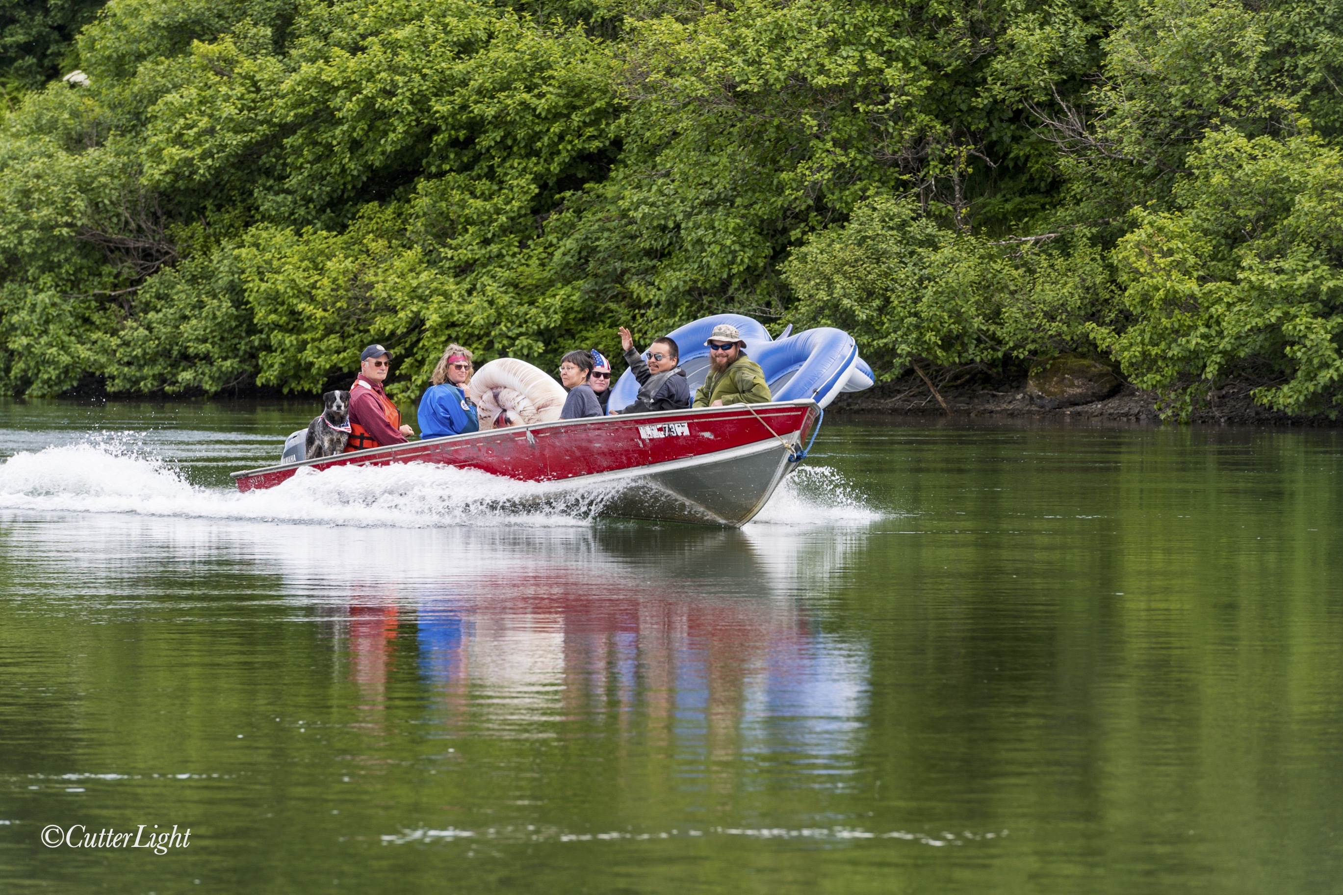
Taxiing up from the weir in a trusty Lund modified V-haul – the Ford F150 of The Chigniks.
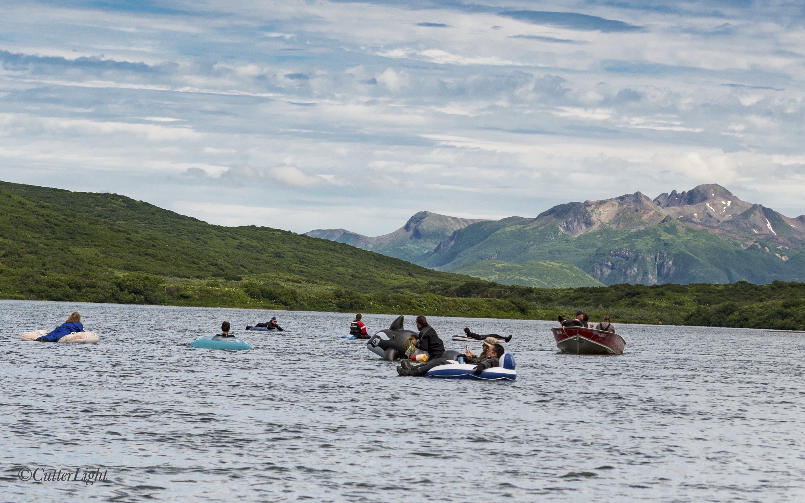
We quickly threw together a few things, walked to the lake beach in front of our house, fired up the skiff and cruised down to a gravel bar where Alaska Fish & Game weir summer staff were assembling with a variety of floating devices – including the “Shamu” Willard had mentioned. Before us was a wilderness river and the perfect day for a Fourth of July float.
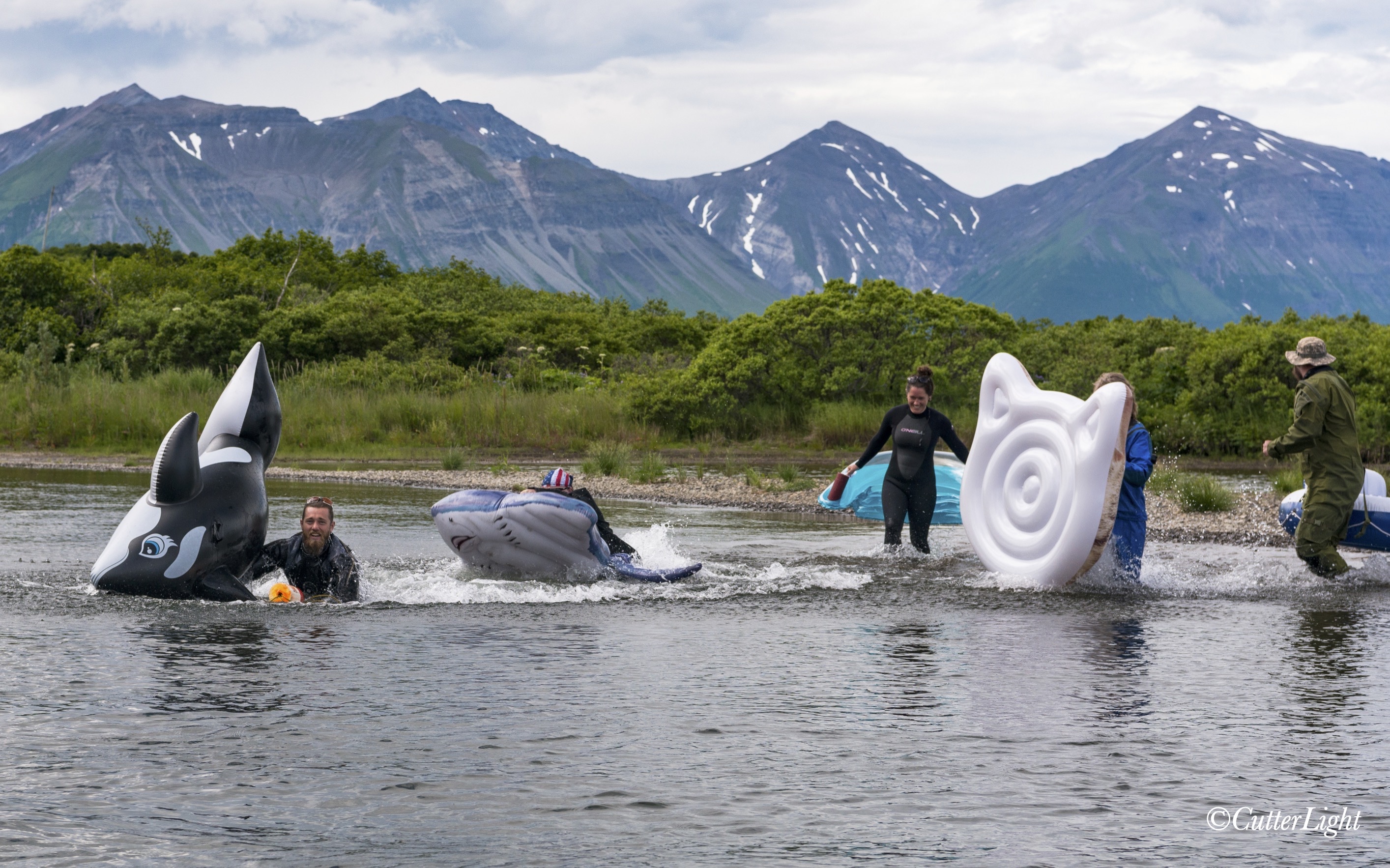
The splashy start of the regatta – a two-mile race to the weir
With about half the participants already on the gravel bar, we waited around for the other half to taxi up by boat from the weir. Salmon parr dimpled the surface of the river and an occasional Sockeye showed itself with a splash. Eagles soared in the distance, and directly across the river, a Brown Bear found a shaded spot beneath an alder and plopped down for a rest.
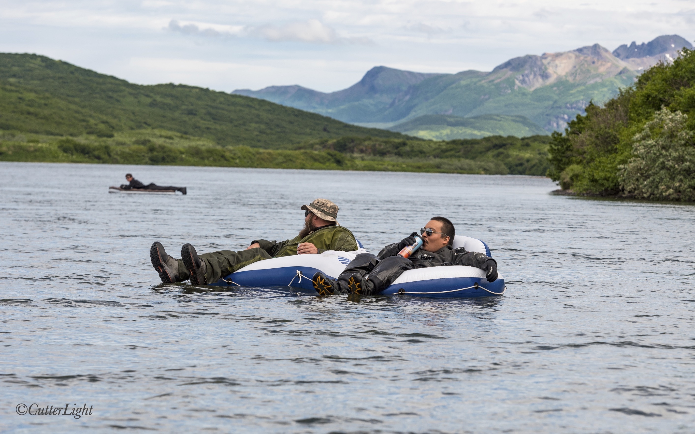
As races go, this one was pretty casual.
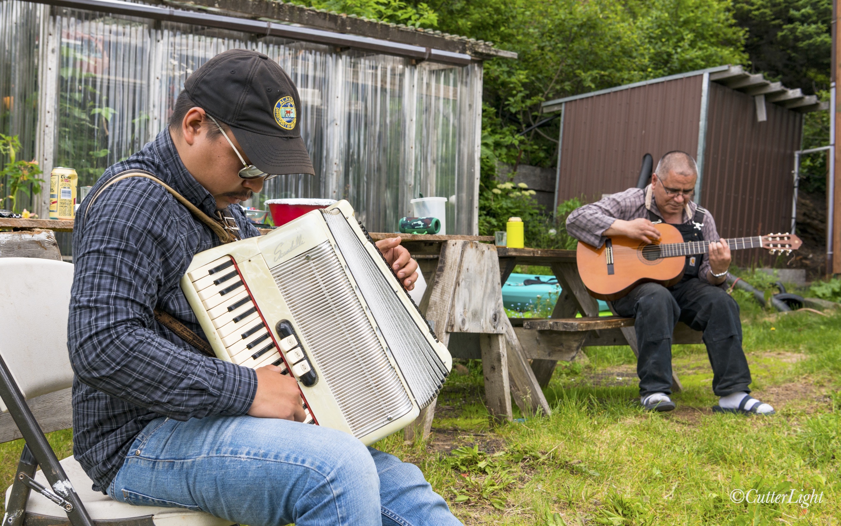
With boats beached, docked or deflated, Willard (right) and his son William got things going with live music. The talented Lind family has been playing all kinds of music on all kinds of instruments for generations.
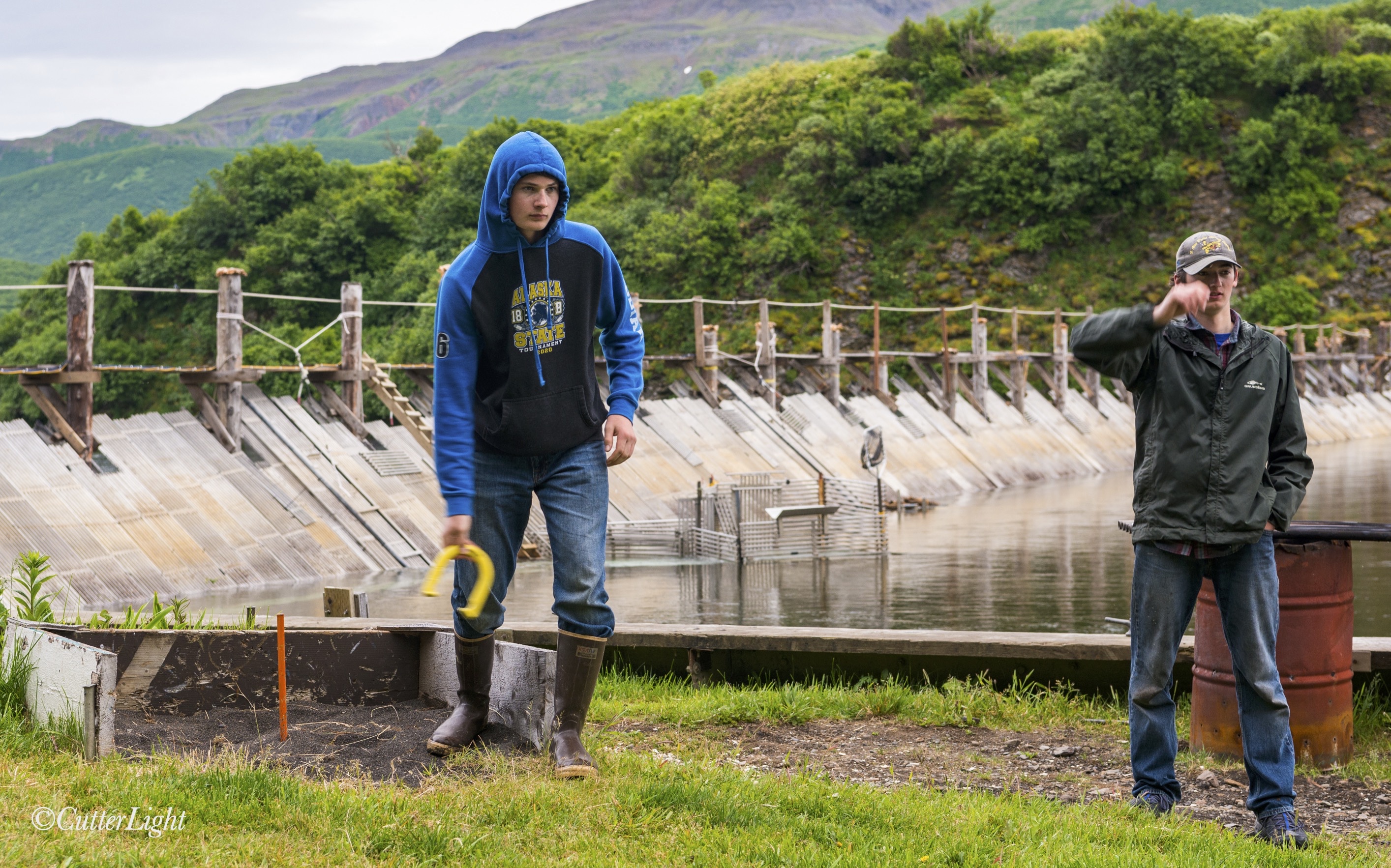
The weir makes an unusual backdrop for a game of horseshoes. This is where the Chignik’s salmon are counted – hundreds of thousands of fish annually. While we were playing, thousands of salmon – mostly Sockeyes but also a few Chinook as well as a couple of seals – were milling around behind the weir. There’s an escapement opening in the weir – you can see it indicated by a fenced corral area between these two horseshoes participants. Seals as well as salmon use this passage. Cameras connected to monitors inside the weir station record ascending fish.
I hadn’t played horseshoes in 40 years and was game to jump into a 10-participant tournament. After knocking the rust off my tossing arm, I even managed a couple of ringers and a leaner! I rewarded myself with samples of the seven basic food groups – moose, King salmon, chicken wings, baby-back ribs, scallops, cheeseburgers and, for dessert, a perfectly charred, deliciously salty hotdog all hot of the grill. For “salad,” I dug into slices of apple pie and rhubarb cake. No one makes friends with salad! 😉
Heading back upriver to our tiny village on the lake
It doesn’t get dark till after midnight this time of year in the Chigniks, and besides, some of us had to make the upriver run back home. So the fireworks came out while there was still light in the sky. A few pops, bangs, sparkles and smoke, and another Fourth had been properly celebrated – Chignik Style.
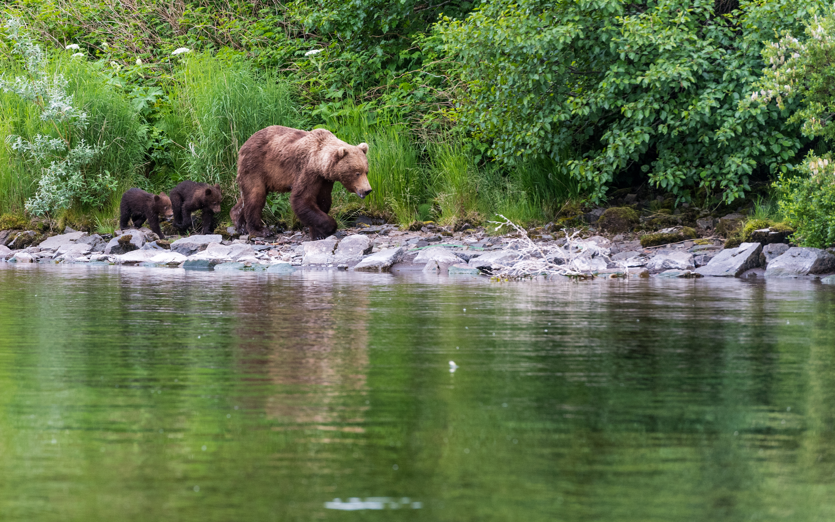
Almost home, we came across mama bear and her two cubs. With the early salmon run down compared to previous years, she’s looking a little thin. Hopefully things will pick up with the late run and everyone will get all the fish they want.
Here’s hoping everyone is having a safe, happy summer!
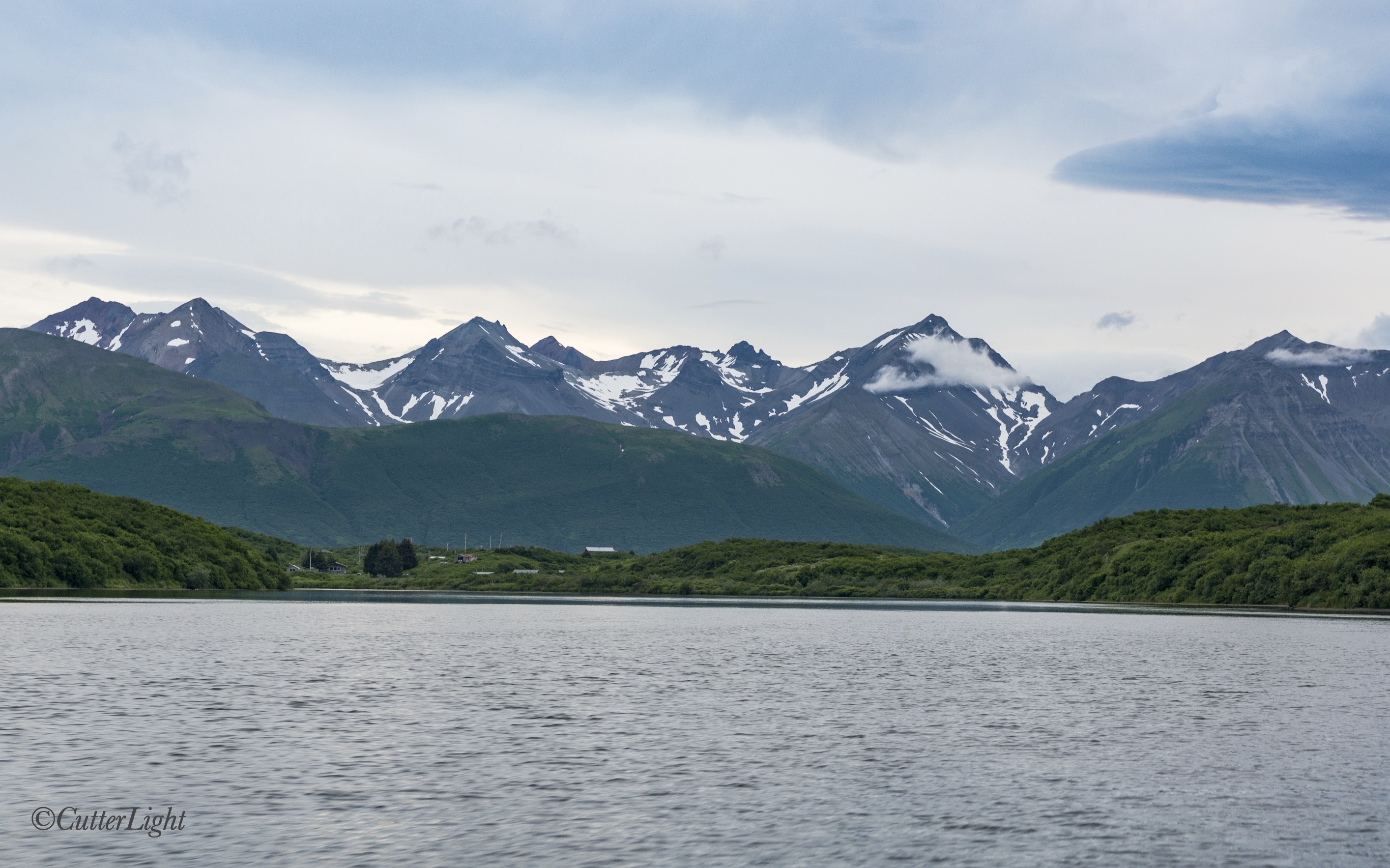
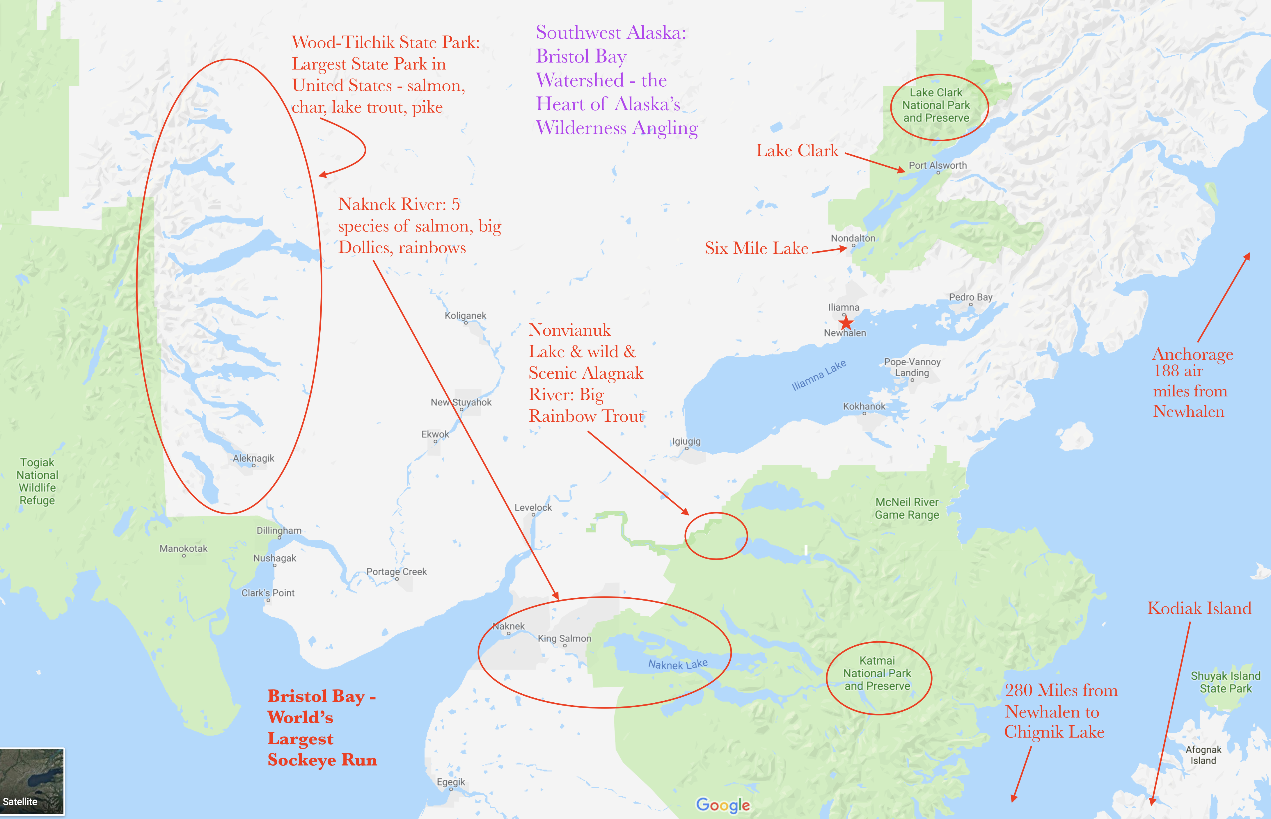
The red star (just right of center) marks Newhalen, Alaska – our new home at the mouth of the Newhalen River on the shores of Lake Iliamna. Temporarily up in the air this past spring with the closing of the school in Chignik Lake, we’ve landed in the heart of some of the best trout and salmon fishing in Alaska – and hence in the world.
On June 21st, we said our goodbye-for-nows to friends in Chignik Lake, boarded a small bush plane, and bid farewell to the tiny village in the Alaska wilderness that had been our home for the past three years. Our summer has been something of a whirlwind since.
A parting view of our wonderful village on Chignik Lake. The red dot (near center) marks our home there. The good news is that in late July, a family with children moved to The Lake, so the school is restored to the minimum enrollment necessary to open this fall.
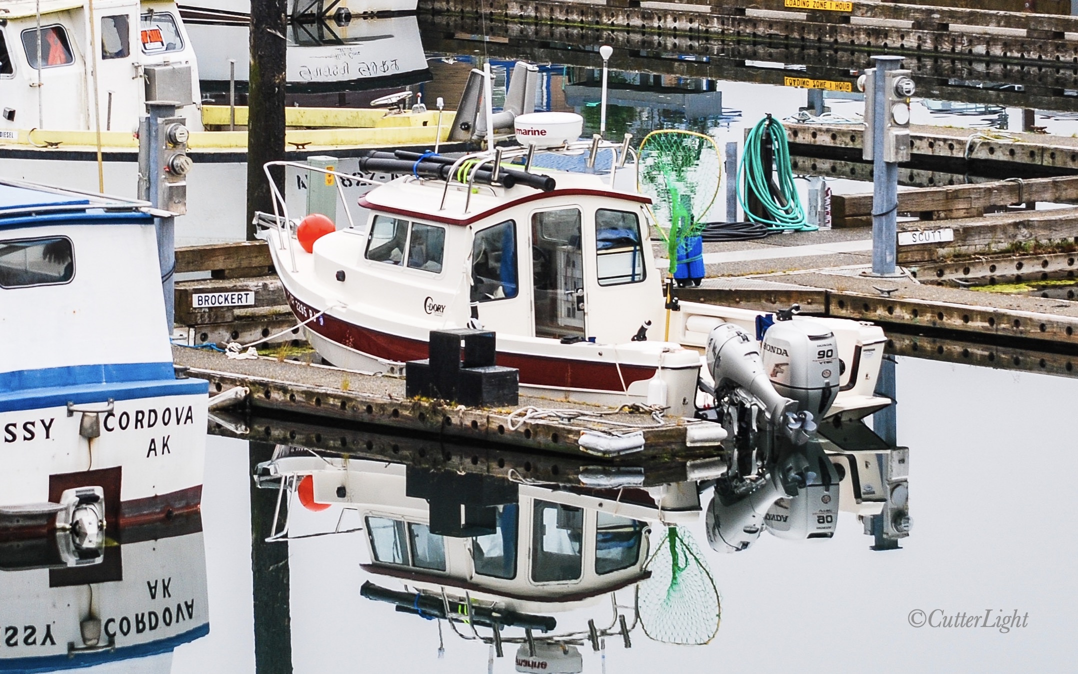
From The Lake, we flew straight to Newhalen and began familiarizing ourselves with our new community. The house we were to move into was still occupied, so we quickly tucked ourselves into a nearby apartment, boarded another plane, and flew across Cook Inlet (the large body of water on the right side of the above map) to Homer where our truck, camper, C-Dory fishing boat and canoe have been in storage. The scramble was on.
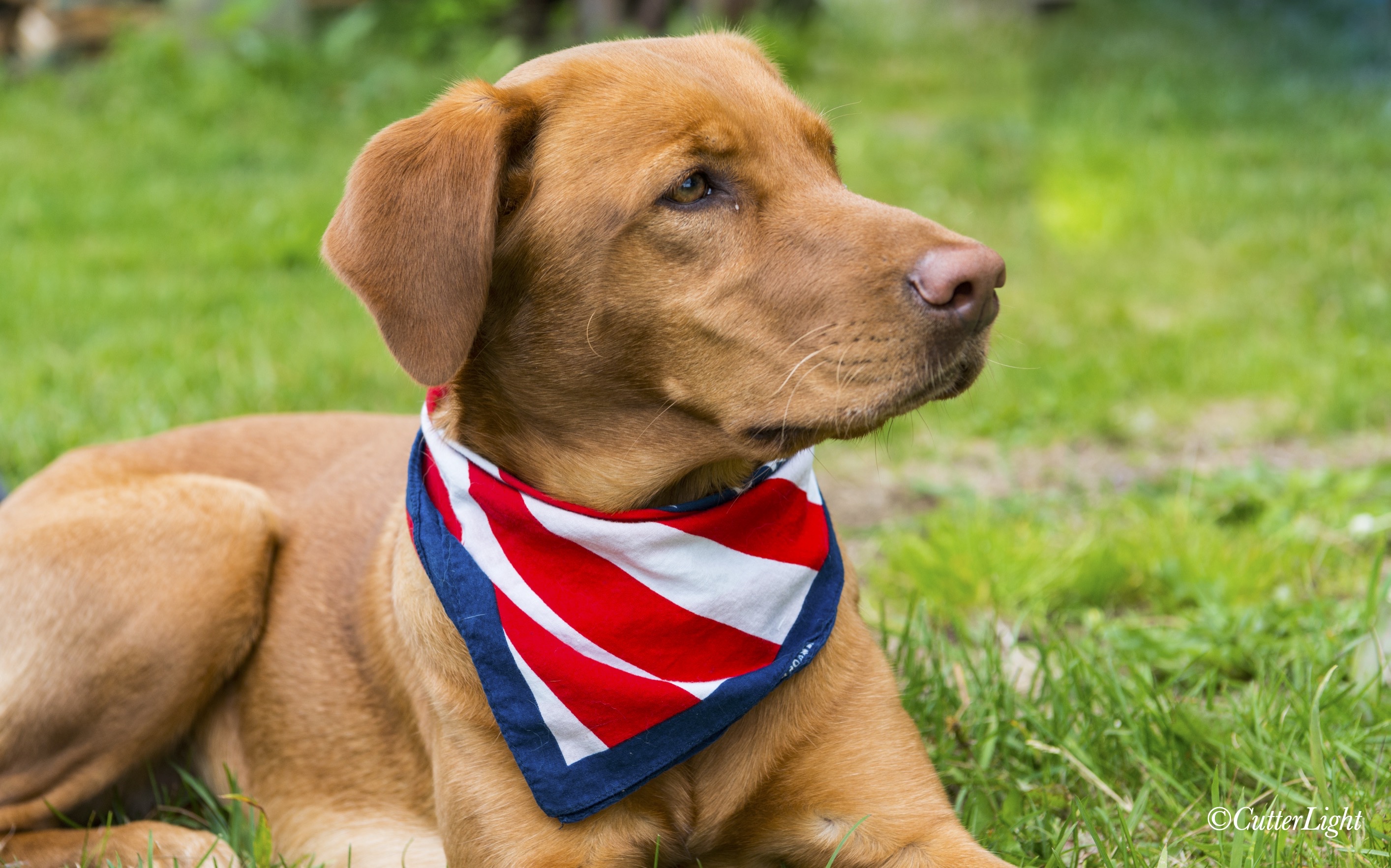
It’s hard to believe this photo of Gillie was taken over 10 years ago in Cordova, Alaska. She’ll be happy to be exploring Lake Iliamna and other nearby waters near our new home.
Six days later, we’d made the drive to Anchorage to take care of errands, appointments and catching up with friends, drove back to Homer (450 miles round trip), delivered the truck, canoe and boat to a transportation company to be barged across Cook Inlet, driven on a haul road to Lake Iliamna, then barged across the lake to our home, returned the camper to storage in Homer, then flew back to Newhalen. Two weeks later, our house-to-be opened up and we began moving in. Since then, we’ve been engaged in daily projects large and small, turning this house into our home.
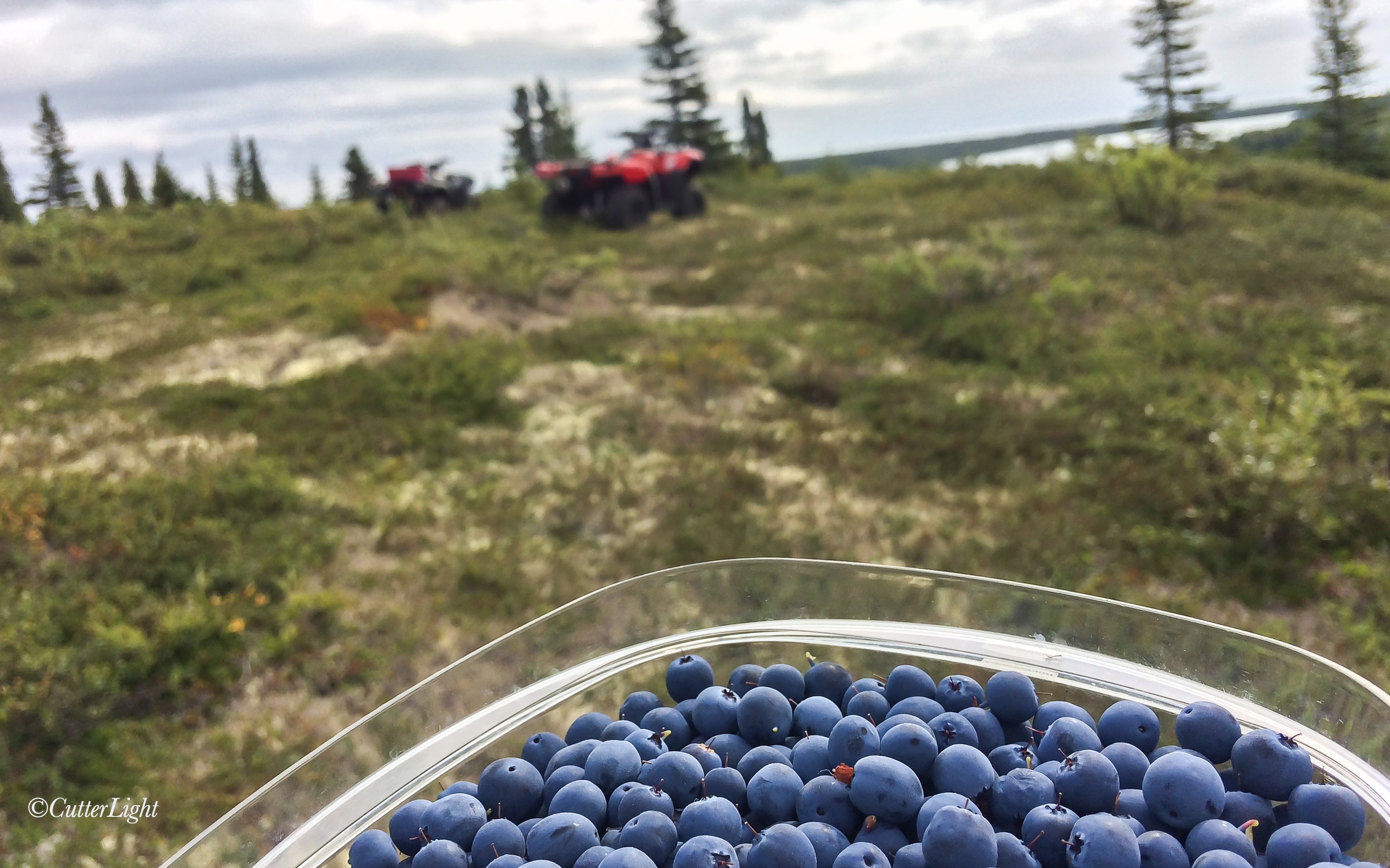
Meanwhile, we’ve been sandwiching in regular runs in preparation for the half-marathon we’ve signed up for in October, tying flies, catching salmon and putting away 100 pounds of beautiful Newhalen River Sockeye in our freezer, squeezing in a little guitar practice, picking blueberries (gotta have berry security for the coming months) and managing to still have time for our traditional evening games of Scrabble or chess. We’ve barely touched photography and writing during this time.
A thick mattress of soft lichen makes sitting or kneeling to pick blueberries quite comfortable. There is also an abundance of lingonberry (low bush cranberry) along with crowberries and, here and there, cloudberries.
We have begun to get the lay of the land. For about three weeks in mid-July, a nearly steady stream of tens of thousands of salmon ascended the Newhalen River. The fish get temporarily bottlenecked at The Rapids – a spectacular piece of unnavigable white water that forces the salmon close to the banks were anglers (such as ourselves) attempt to get a fly into their mouths. Where there are salmon there are bears, and although we haven’t seen any yet, there are signs of their presence. We have seen a couple of foxes, a set of moose tracks, and a number of interesting birds including ospreys, merlins and loons. The landscape is a mix of tundra with berry patches everywhere (and I mean everywhere) and taiga forest predominated by black spruce and some white spruce. The horizon is shaped by mountains.
With very limited roads, Hondas (ATVs/quads) are a great way to get out and explore. There are extensive trail systems lacing through the area.
With only a few miles of road and no practical way in or out of the village except by plane, this is till the Alaska bush. But coming from truly remote Arctic villages such as Shishmaref and Point Hope as well as Chignik Lake nearly 300 miles down the Alaska Peninsula, Newhalen and its sister village five miles up the road, Iliamna, are like no bush village we’ve lived in. Some of the roads here are paved! This is a hub for commercial fishermen, sport anglers and eco-tourists, and as such, the area has a decidedly cosmopolitan feel about it. Fairly large planes fly in and out, there is a modern, fully-staffed health clinic, a small grocer and a slightly larger, exceptionally well-stocked general store that carries everything from food to hardware to clothing with even a little fishing tackle in the mix. And get this: we can now get same-day delivery from Costco. It almost feels like cheating. “Cush Bush,” we’ve heard it called. Or “Bush Lite.”
At the same time, there are only about 300 residents between the two villages. During our three to five mile morning runs along the main road, we’ve never seen more than a handful vehicles. And the people here are super friendly. New friends at the airport call us when we have freight, and folks at the post office are happy to do the same when we’re expecting something important. Whether we’re on our bicycles, running, or driving our pickup, virtually everyone waves as they drive by. And it’s quiet. Not Chignik Lake quiet, but aside from an occasional plane, once we’re beyond the edge of town all we can usually hear is birds chattering and the distant roar of the Newhalen River. Inside our home, we hear almost nothing from outside. There are no police officers, virtually no litter, and most people don’t bother locking their doors.
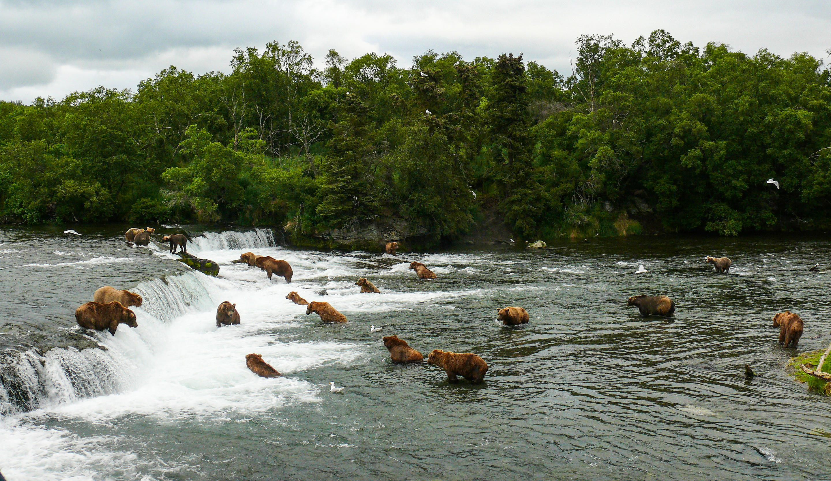
Coho Salmon will be arriving in the river soon. A few miles beyond the village the Tazimina River is renowned for trophy-sized grayling and rainbow trout over 20 inches. Fly fishermen catch rainbows that large and larger at the mouth of the Newhalen, a 15 minute walk from our home. We’re a short bush plane ride from Katmai National Park, famous for the Brooks Falls where massive brown bears gather to intercept migrating salmon. As part of the Bristol Bay watershed, rivers that fill with salmon, not to mention trout and char of huge proportions, lie in just about every direction.
When I was a young boy, sometimes my grandfather Donachy would let me have his old issues of Sports Afield, Outdoor Life and Field and Stream. I’d pore over those magazines, reading them cover to cover and then reading my favorite articles again and again. That’s where I first learned of Lake Iliamna, this massive body of water fed by streams and rivers filled with fish, its shores patrolled by wolves, bears and moose, a few isolated Indian villages dotting the landscape, bush planes the only way in… It was the stuff to make a young boy dream.
Well. Here we are.
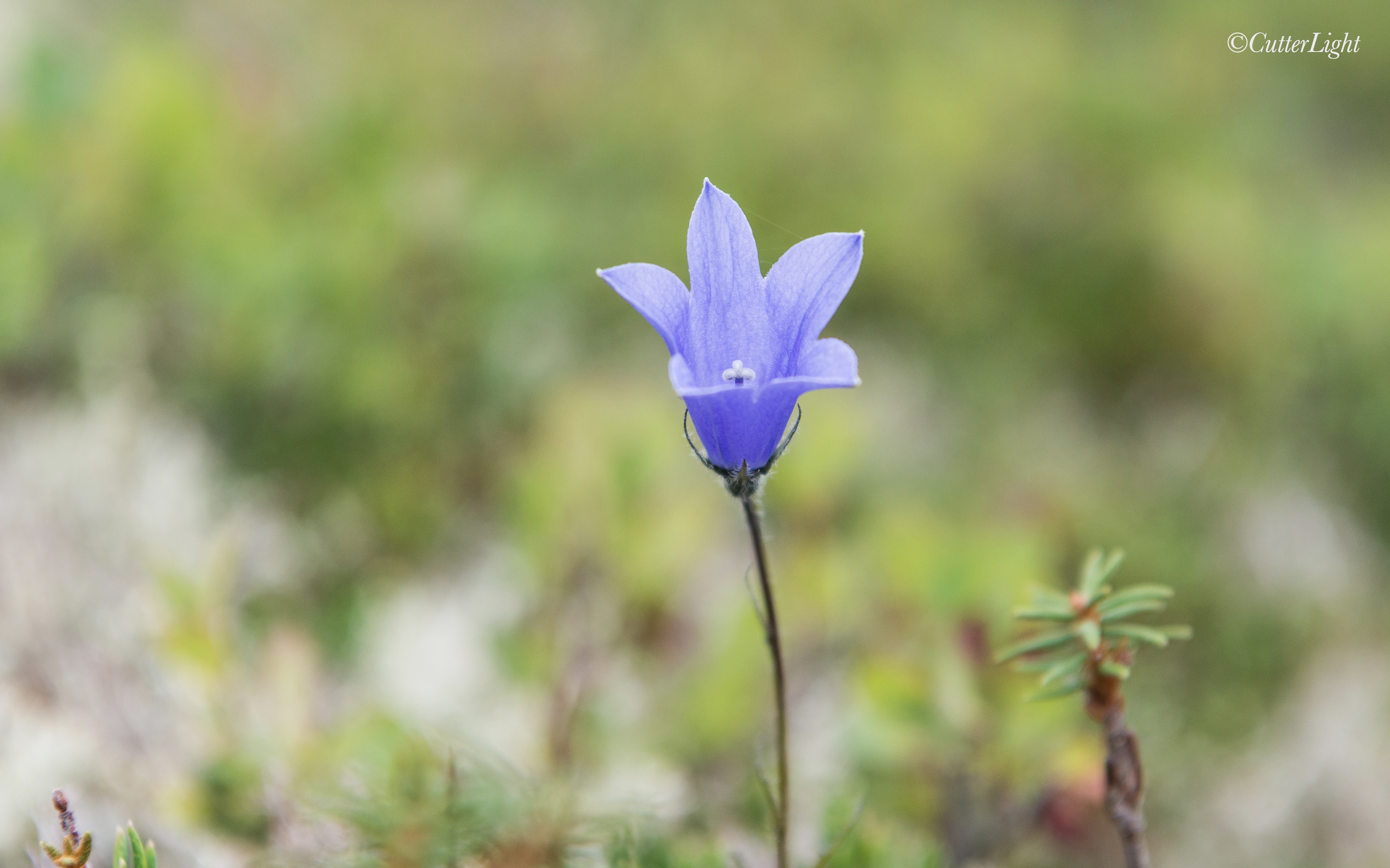
Fireweed flowers are near their finish, but here and there harebell is in full bloom. We’ve finally got our cameras out and are beginning to really dig in and explore this exciting part of Alaska, so stay tuned!
Almost surreal in it irredescence, this agehachou is one of the many stunning butterflies we’ve encountered on our Hokkaido bike trek.
We’re not lepidopterists, but it would be all but impossible not to notice the incredible beauty and diversity of the moths and butterflies – not to mention the amazing variety of caterpillars – we’ve been encountering on our bike trek around Hokkaido, Japan. If you find them early enough in the morning when they’re still warming up, you can sometimes sneak a decent photo. This agehachou (Asian swallowtail) is among the more stunning butterflies we’ve found, but it seems that all butterflies are beautiful. As the summer progresses and flowers change, different species are emerging. Today the paths were filled with nearly iridescent black caterpillars, leaving us wondering what form they’ll take as adults.
Barbra and a young friend cheese it up for the camera at Yagishiri’s ferry port.
A cool ocean breeze drifted in across the Sea of Japan and the sun was shining brightly as we set up our tent on Yagishiri Island. Brilliant orange-yellow Day Lillies speckled the green, gently rolling countryside around us. It was easy to imagine the Suffolk sheep the island is known for tucking their black faces into tufts of rich grass and quietly grazing a few hillsides away.
Yagishiri is home to Suffolk Sheep. Brought over from Scotland, they grow cute and tasty on the island’s lush grass.
The campsite was ideal. Our tent was nestled into a flat between hills and protected from coastal gusts by a small building. The campsite featured cold running water, an immaculate restroom, and even an outdoor shower.
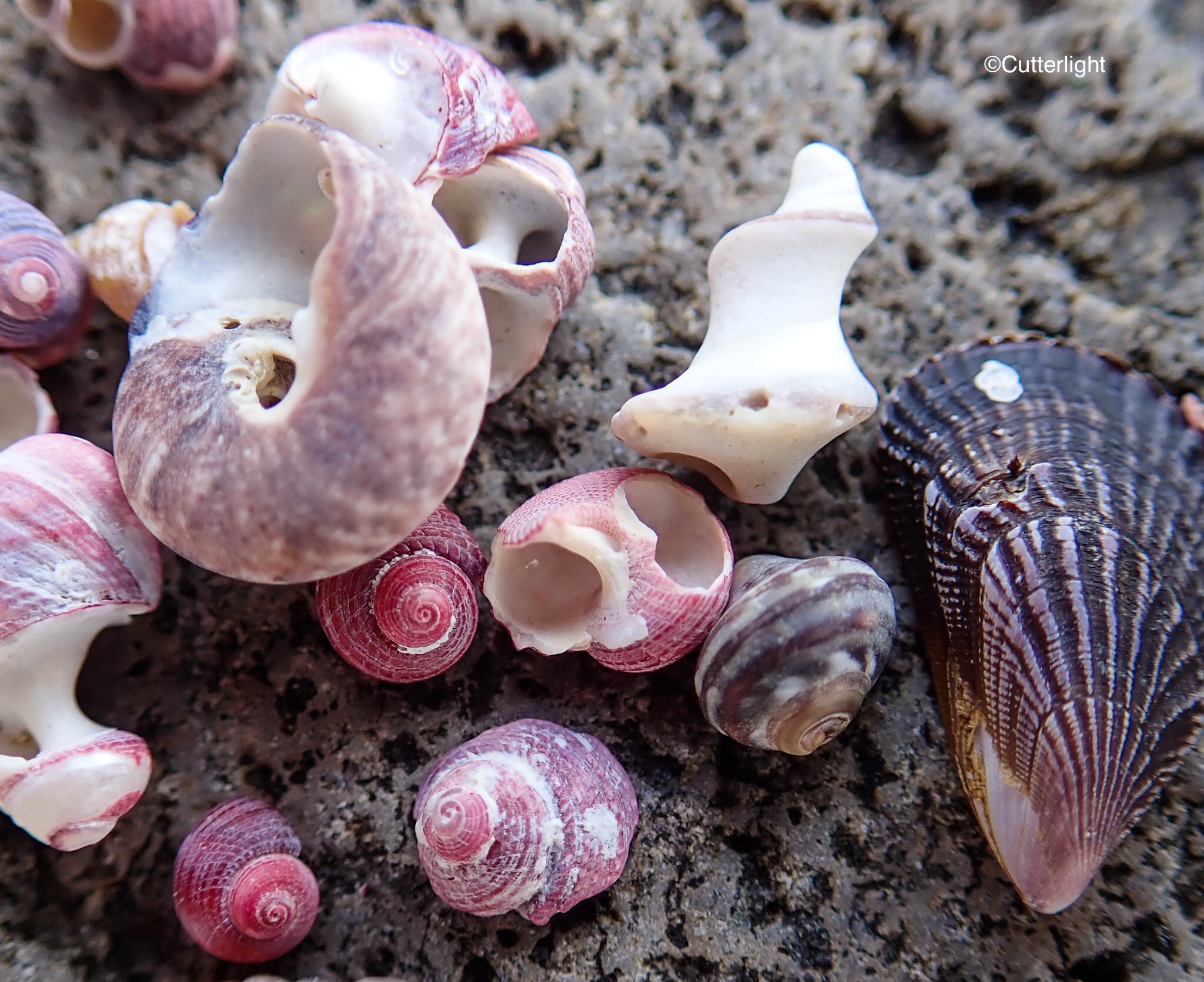
We stowed our bike bags beneath the tent’s fly and headed down an inviting pathway to what the map boasted as a swimming beach. Although the sun was high in the sky, I wasn’t prepared to take a chilly Sea of Japan swim. I noticed that the beach was covered with countless tiny treasures – blue, green and amber beach glass polished smooth, crab husks, miniature clam shells, dried sea urchin shells- some with their spines still attached, and colorful small rocks with interesting patterns. Larger flat rocks offered perfect surfaces on which to create found art displays with favorite finds from the beach. What a lovely, relaxing way to spend part of an afternoon.
Yagishiri-to (Yagishiri Island) is a short ferry ride from the town of Haboro on Hokkaido. There is one main road that follows the island’s perimeter which is only 12 kilometers (just over seven miles). After exploring the beach and with our bike bags stowed at the campsite, we hopped onto our now feather-light bikes and went out to discover the rest of the island.
As the sun moved in and out from behind a few gathering clouds, I couldn’t help but smile. When I was young, my family traveled a good bit. During those trips, I fantasized about having my bike with me so I could explore those places at a bike’s pace – slow enough to catch all the details around me but fast enough to actually get somewhere. It’s exercise up the hills, the coast back down a pleasantly earned reward.
Off in the distance we began to hear the rumble of thunder. We had nearly reached the opposite side of the island from our camp. Looking out to sea, we tried to discern which way the thunder was coming from. Toward the sea, the clouds were thin and light. Looking toward Hokkaido’s mainland, the clouds were thick with rain.
Rather than turn back, we decided to continue around the island. We guessed the lighter clouds were coming our way. However, a few minutes later, big splats of rain hit us. Seems we are not meteorologists! Near the top of a hill, we spied a path leading into a small forest which, according to our map, would lead to a shrine. We decided a quick side trip there might give us shelter from a burst of rain. We found the shrine in a state of some disrepair. Tall grass grew around the gate-keeping statues and stone lanterns, and scattered ladders and work tools gave the site the look of a place that was on someone’s to-do list.
Suddenly the clouds ripped open as a torrent of rain poured down. We sat on the dry steps of the shrine enjoying the sounds of rain drumming on the forest canopy while birds chittered complaints in the forest and tree frogs sang in celebration. It was lovely to wait out a squall with no appointments to attend to and no plans for the afternoon. As squalls do, it passed. We got back on our bikes and continued our tour of the island.
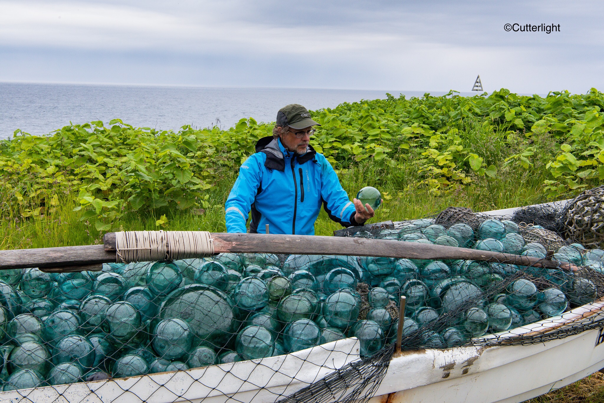
A treasure trove of glass floats filled this small fishing boat to the gunwhales.
As we neared the highest elevation on the road, lightning flashed in the distance. This time, it seemed clear the angry cloud mass was heading straight for us. There was no more leisure in this ride; it was time to get back to camp. The flashes and booms were still over ten miles away according to our primitive counting measurement system – one one thousand, two one thousand, three one thousand… The race was on.
As we neared our campsite, the clouds opened up and once again began to unleash sheets of rain. We hurriedly parked our bikes, grabbed our water bottles and rushed to the tent. As we did, we noticed something strange: the side of the building we were camped by was now open. It seemed magical. We hadn’t noticed any type of opening when we set up the tent. It turns out there was a rolling door, like a garage door. While we were gone exploring, some kind person had come along and opened the building for us. The opening revealed a friendly space with a dry concrete floor, kitchen sinks and stainless steel countertops – a perfect place to duck in out of the rain and cook our dinner!
We positioned our camp chairs near the opening and watched our poor tent get pounded by rain. Soon the thunder and lightening passed directly over us. I’ve always loved watching lightening storms. It was exciting and wild to have the strikes pass close by. We counted them as close as two miles away! Eventually the storm faded across the hills, across the sea and into the distance.
Rain, rain and more rain – waiting for a lull in a series of squalls on Yagishiri-to.
By now it was getting late. Our bellies were full of a hot soba concoction Jack had whipped up and our bodies were warmed by the last sips of peaty, smoky whiskey from a purchase at the Nikka Whiskey distillery. With the rain waning, I t was time for bed.
Our little tent is amazing. It had been thoroughly doused. Yet the fly had held out through the worst of it and our sleeping bags and all of the gear inside the tent was snug and dry. Nestled inside our cocoon, we both quickly drifted to sleep.
Then –
Flash! Crack! Boom! The lightning and thunder came in nearly simultaneous sequence, jolting us awake.
While we had been soundly asleep, another intense squall had crept upon the island. This time the lightning strikes were practically on top of us. Two in a row where there wasn’t time to count to one thousand-one between the nearly blinding flash and the earth-shaking boom had our eyes wide open. A tent previously described as “tough” and “sturdy” now seemed to be but a flimsy piece of nylon separating us from the elements. “Give me your hand!” I demanded of Jack. I grabbed his hand as another Flash! Crack! Boom! pounded down from the heavens. I squeezed my eyes shut but couldn’t keep out the blinding flashes. I plugged my ears to muffle the thunder’s roar. I wondered about people who’d been struck by lightening and had survived. What did that feel like? Were we going to be one of those stories?
“We’re in a low place,” Jack assured me. “We’ll be fine.”
The next blinding flash lit up the tent. This time the roar of thunder came after “one one thousand.” Maybe it was moving away? I still clung to Jack’s hand. Another blinding flash. I buried my head in my sleeping bag and counted – one one thousand. Then, right away, another flash – one one thousand, two one thousand. My heart was still racing. While this squall seemed to be passing, I wondered if another set of storm clouds would move in.
A few minutes passed and another flash came – one one thousand, two one thousand, three one thousand, four one thousand.
As the thunder and lightning slowly drifted further away, I finally released my grip on Jack’s hand. My heart slowly returned to its normal rate as the drumming of rain on our tent softened. For the remainder of the night it rained and rained, but the thunder and lightning had ceased. The next morning, I woke up wondering where exactly the lightening had struck. A moment later, I felt grateful that I didn’t know.
Hokkaido is rich in the world’s most valuable natural resource: clean, fresh water. This falls was one of many we’ve encountered so far this summer.
The most frequently visited of the six national parks in Hokkaido, Shikotsu-Toya as a fragmented network of lakes, mountains and geothermal features. Japan’s national parks represent a much looser management philosophy than those of the United States and Canada. Visitors’ centers are fairly minimalistic, featuring perhaps a few pamphlets in Japanese, Chinese, Korean, English and occasionally Russian. There are no entry fees. Tent camping may range from a high of about ¥1,000 per person (about $9 at current exchange rates) per night at privately run campgrounds to free. Although campgrounds generally lack picnic shelters, most have areas to wash dishes as well as clean restrooms. Some also offer showers for an additional fee of ¥300 – ¥500 ($3 – $5).
Several hundred brown bears roam Hokkaido’s forests, beaches and mountains. Although uncommon, attacks do occur – prompting these stylized, imaginative renditions of the bears.
Two species of crows inhabit Hokkaido. This aptly named Large-billed Crow was gathering a morning meal of insects. Opportunistic and intelligent birds, we quickly learned that you can’t leave any food unattended.
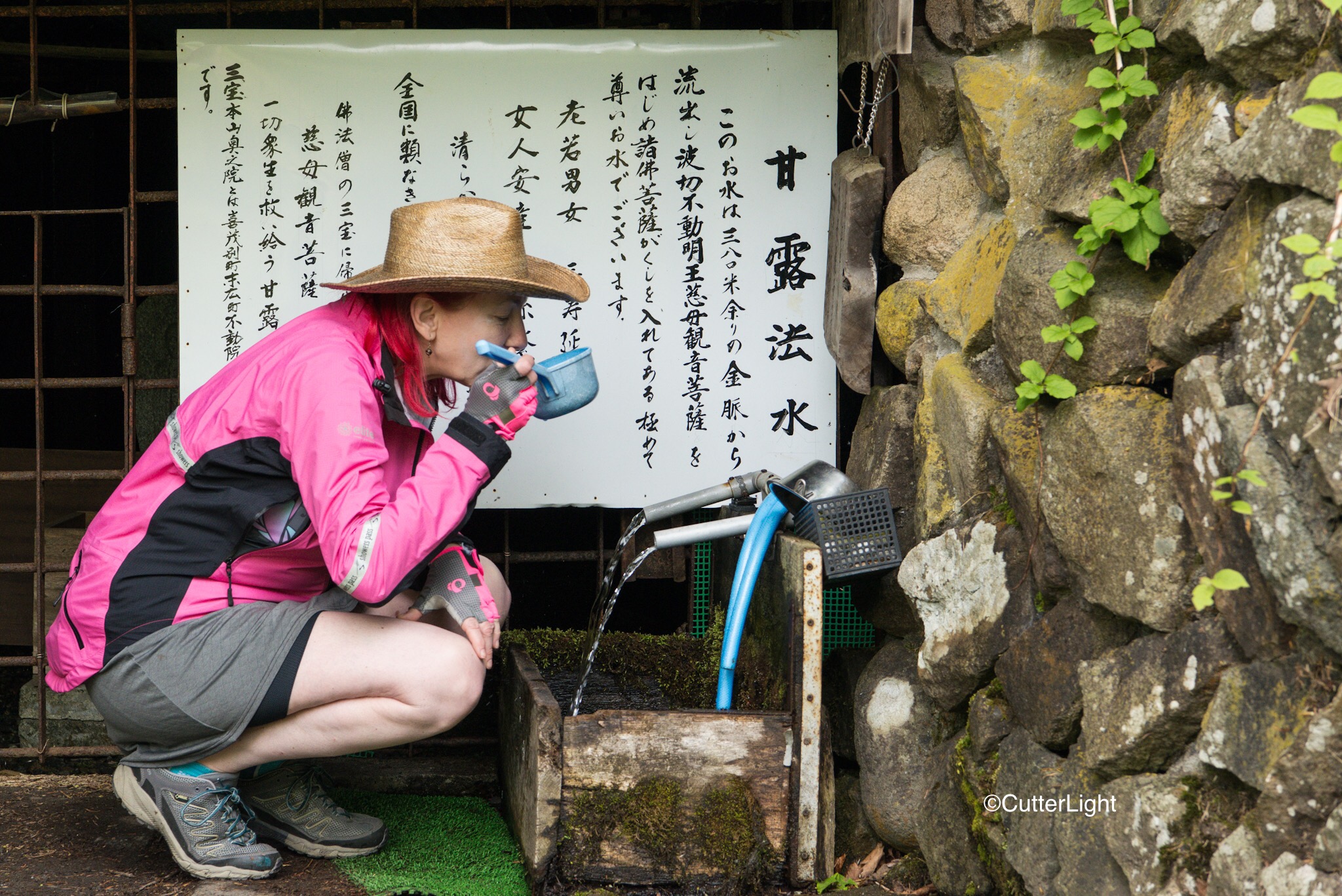
Finding drinking water has been no problem; our favorite sources are the many natural springs we’ve come across.
With schools still in session and nights chilly, early June is still considered the off season in Hokkaido. Campgrounds are often empty on weekdays, and even on weekends it’s possible to find seclusion.
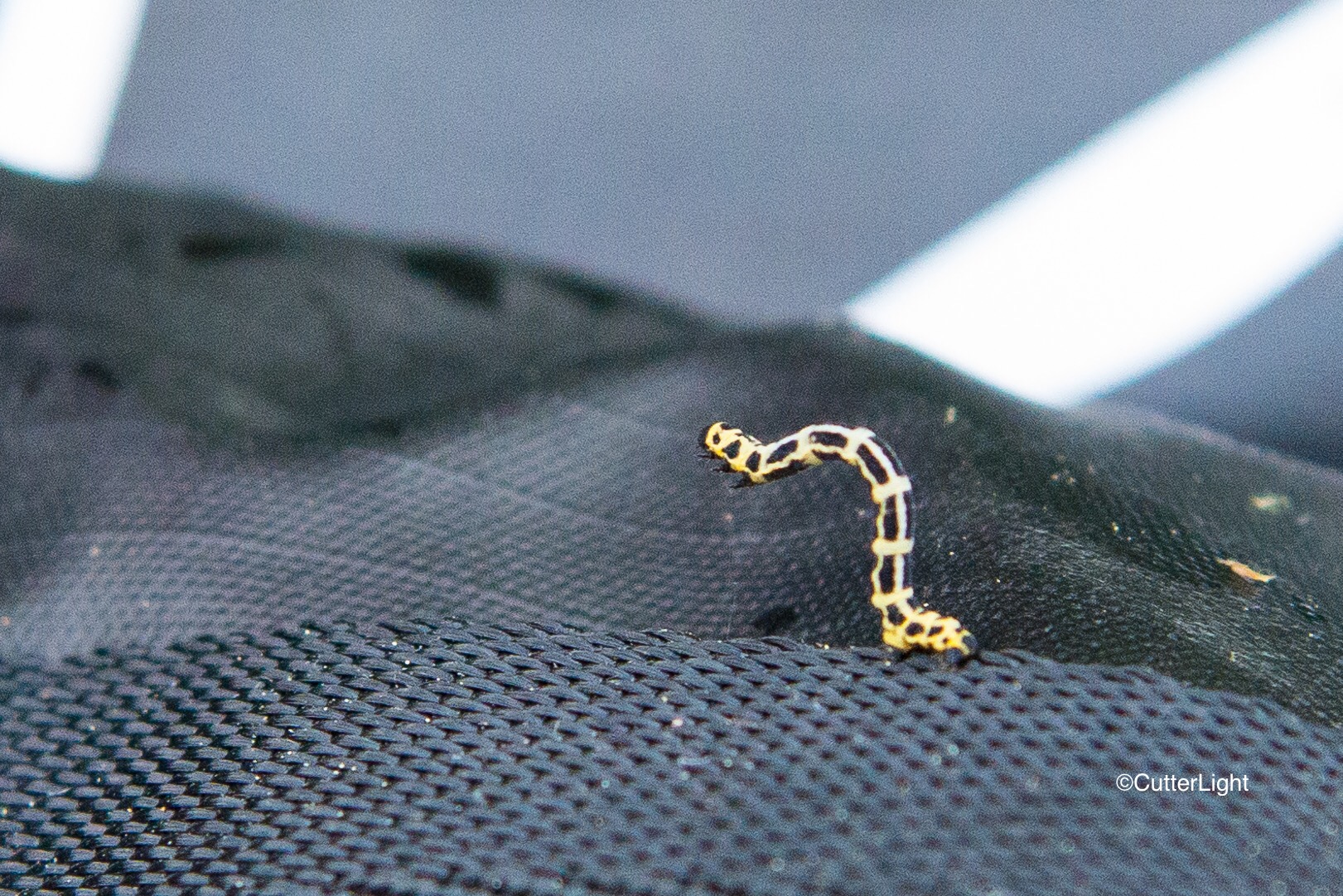
Caterpillars of every description seem to be everywhere. Butterfly season soon.
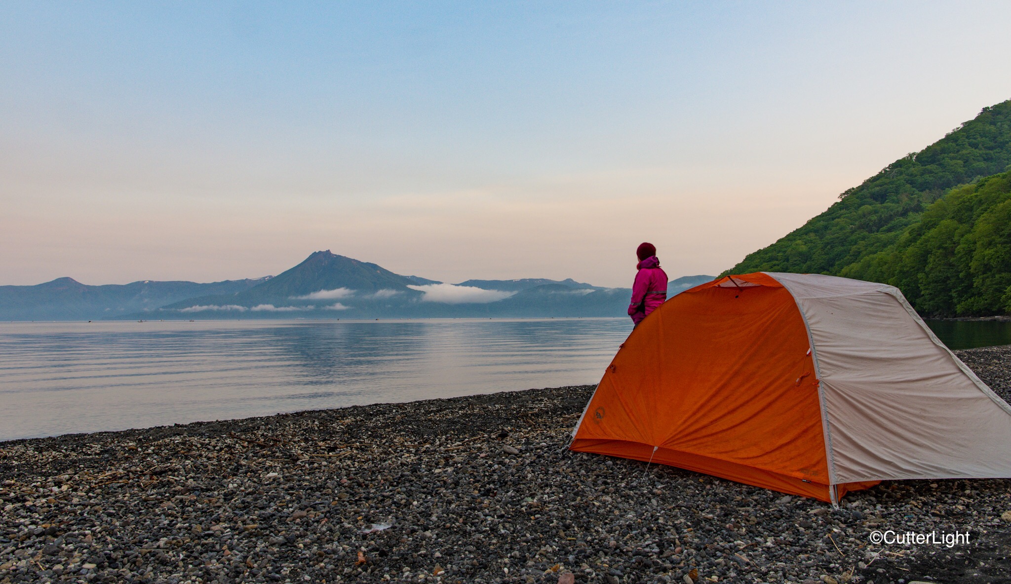
Conical mountains and hot springs belie Hokkaido’s volcanic origins. This beach on Shikotsu-ko (Shikotsu Lake) was covered with pumice – a good bit of which floated nicely!
The last evening light on Shikotsuko.
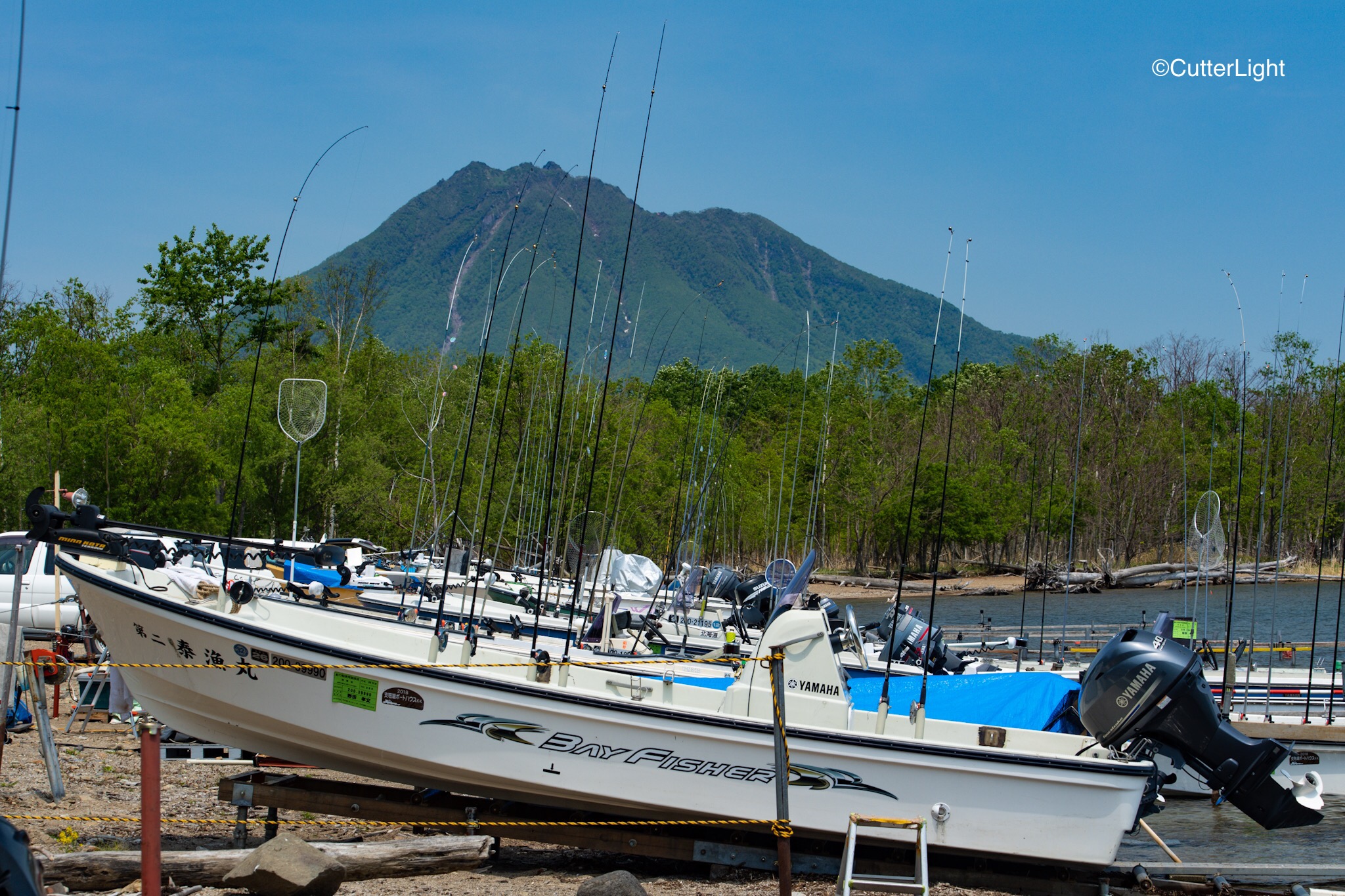
The following day, we rode our bikes along Shikotsuko’s shoreline and happened upon these fishing boats. Rigged for kokanee (land locked Sockeye Salmon), the fishermen hit the water at the first crack of light, take the afternoon off, and then hit it again in the evening.
Centerpin reels, long, limber rods, small flashers to attract the fish’s attention and hooks baited with fly larvae were the tackle and bait choices the experts preferred.
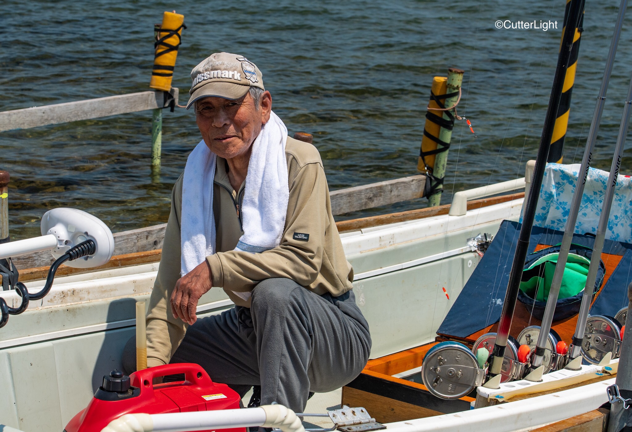
I struck up a conversation with one of the fisherman who then invited me aboard to see his catch – half-a-dozen blue-backed, silver-flanked kokanee in a live well.At 12 inches each, he told me they were running a little small this year, but they still make excellent sashimi.
June is the best season… and I’m guessing that had we had the time it wouldn’t have taken much to get an invite to join him for the evening bite.
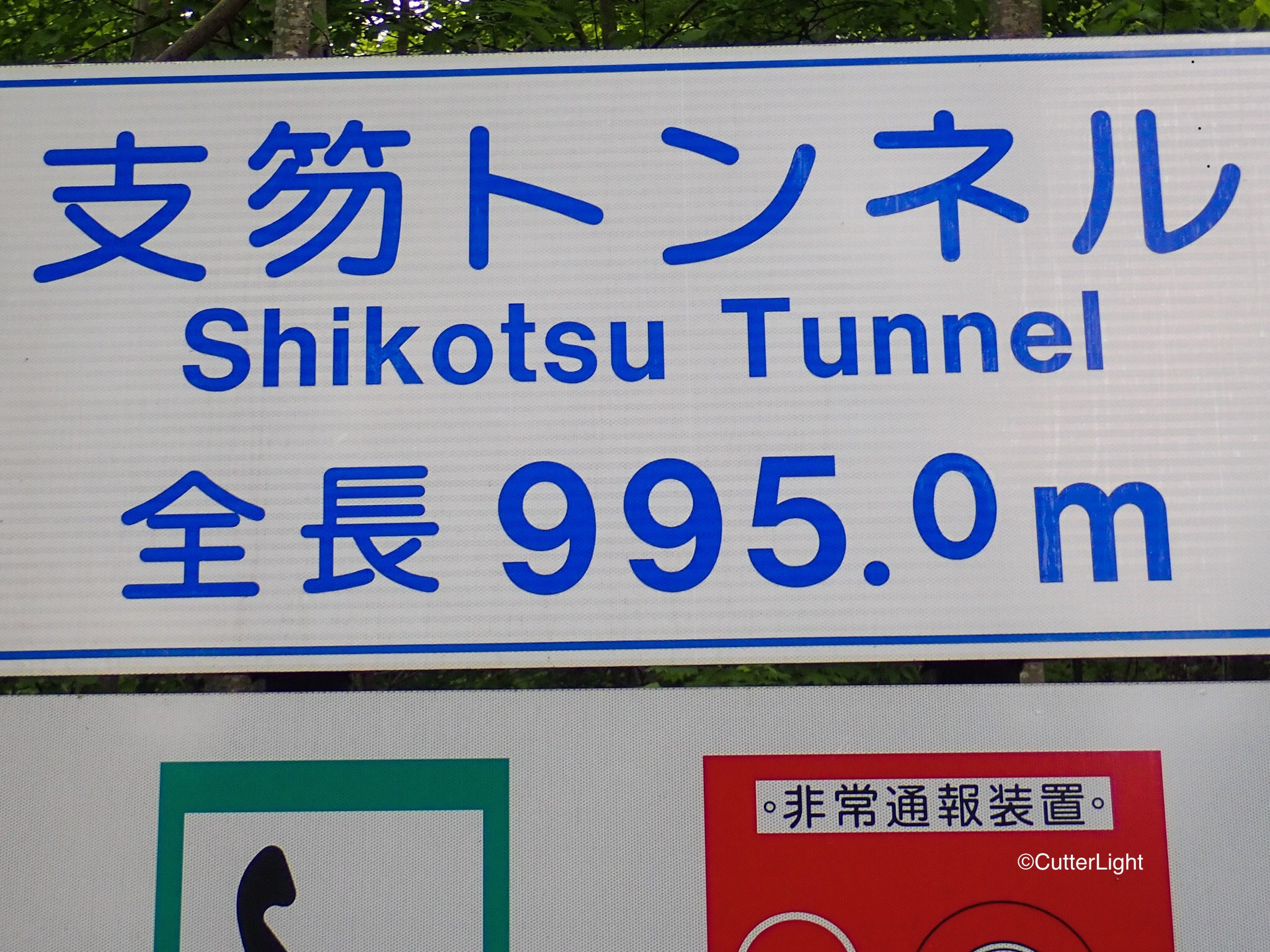
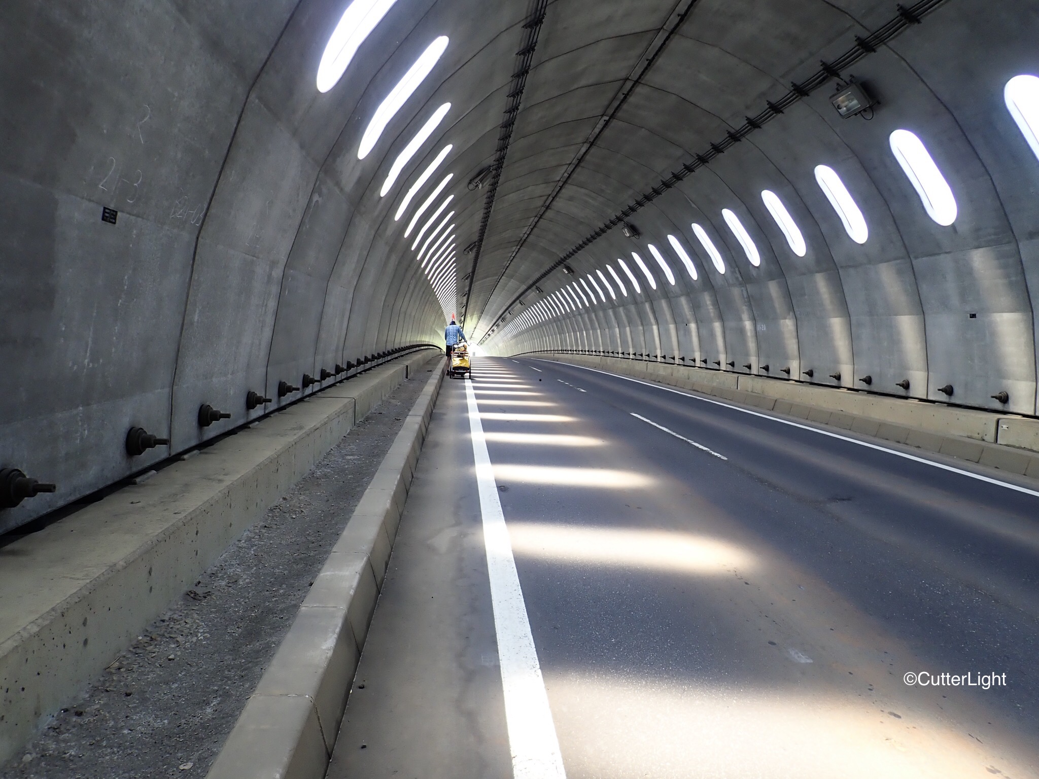
Carrying as much gear as we’re carrying, we expected a fair amount of pushing our bikes up hills and mountains. We were less psychologically prepared for the many tunnels we’ve gone through. Marvels of engineering, they certainly are physically easier than slogging up steep slopes. But with some of them running two miles long and longer – dark, damp, no bike lanes, the slimmest of sidewalks (or none at all) and echoing with the roar of trucks and other traffic – they can wear on your nerves.
A roadside park where we stopped to check out a waterfall featured a number of totem poles presented to Hokkaido by First Nation’s people of Canada.
The colors and style of the carvings seemed to fit with Hokkaido’s indigenous Ainu culture.
Most of the tunnels weren’t as cool as this one. Nice shot, Bar!
A mosaic of farmlands on the flight into Chitose evoked visions of fresh melons, strawberries, cherries, wines, cheese, and Hokkaido’s famous beef.
Although the city of Chitose, which lies just south of Sapporo, is generally seen as merely an airport stop, it’s a charming city in its own right. We found it to be the perfect place to stage and prepare for our trek around Hokkaido. The local Homac store sells butane camping stove fuel, there’s a beautiful green belt, and – as just about everywhere in Hokkaido – excellent restaurants.
A depiction of the Sapporo Beer Brewery paves the sidewalk outside the Chitose airport.
We quickly discovered that convenience stores such as 7/11 and Lawson are not only convenient (they all have restrooms… clean restrooms), but they feature very good coffee and a variety of tasty prepared foods to quickly fuel up hungry bicyclists.
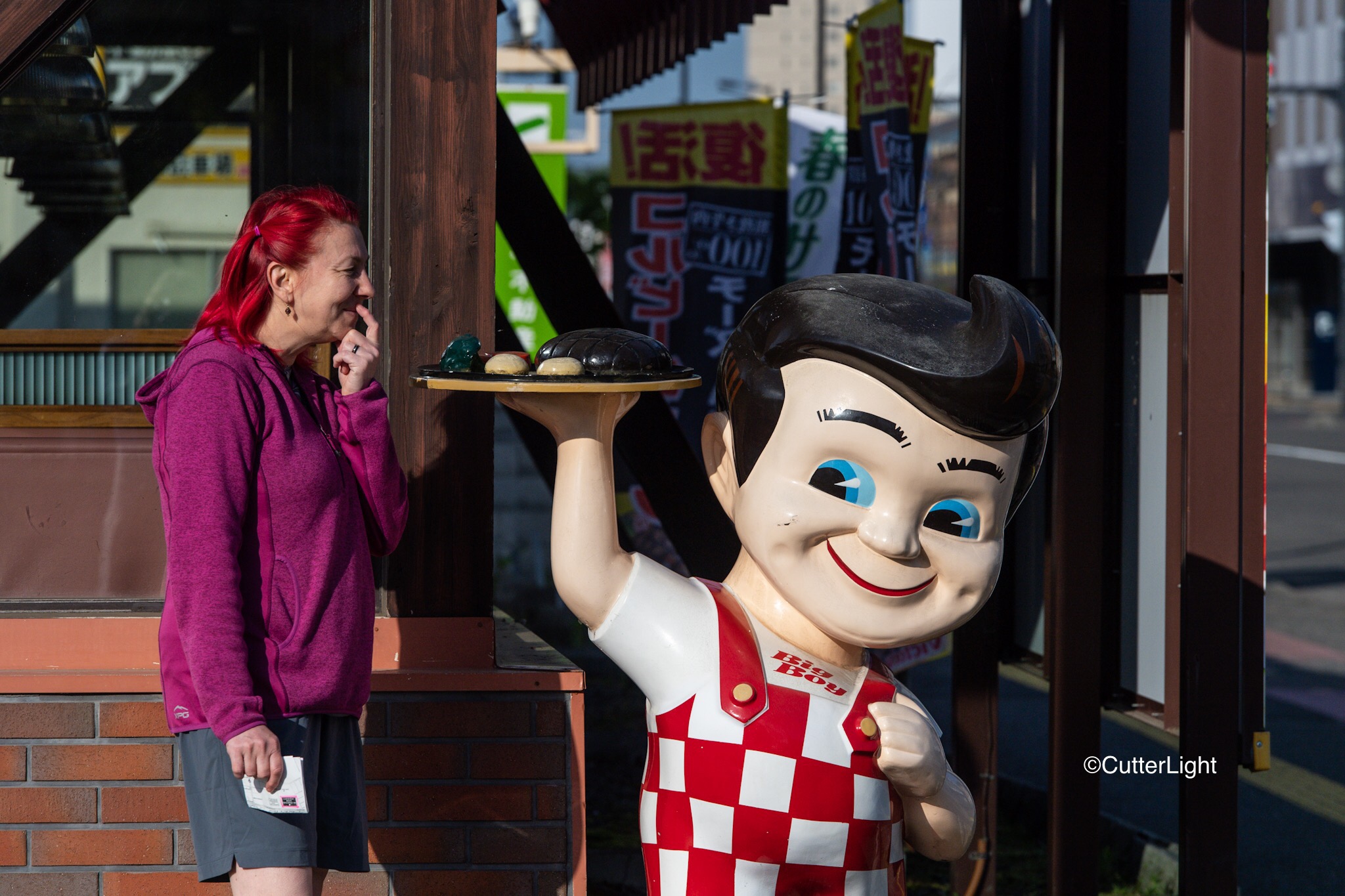
Bob!? Is that you? We hadn’t seen this character since we were kids… Either we were a lot smaller or he was a lot bigger back then. American-style hamburgers have not been on our menu… and I really didn’t care for the way he was looking at Barbra.
A passerby who works with one of the international airlines that frequents Chitose stopped to talk with us as we assembled our bicycles outside the hotel. He recommended the restaurant Ramai, which specializes in curry soup. Chock full of chicken and vegetables and exceptionally flavorful, we enthusiastically pass along the recommendation.
Keen to check out Hokkaido’s young and growing wine industry, we found Grace Winery open for tasting…
…in addition to haskap berry wine (also known as honeysuckle berry), the winery features whites and reds of German origin as well as Pinot Noir. The grapes at this winery were grown in the Yoichi area, which provided all the incentive we needed to make sure that Yoichi would be a stop on our trek!
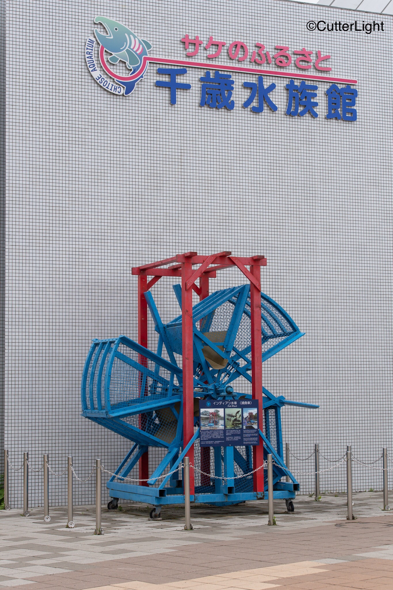
At the the Chitose Aquarium (well worth a visit) we had our first encounter with Ainu culture. The Ainu are indigenous to Hokkaido and northern Japan, sharing many traditions in common with the indigenous people of the Pacific Northwest. Here salmon skin footwear is displayed.
Rare and endangered, Itou (Japanese Huchen) are a close relative of taimen – the world’s largest salmonid species. Growing to over a meter in length, there are still fishable populations in some of Hokkaido’s waters, though catch and release is strongly encouraged if not the law of the land.
The Chitose River is remarkably clean and clear despite running through an urban area. It receives a strong run of Chum Salmon, which each fall are caprtured by this Pacific Northwest style fish wheel for the local hatchery. In late spring and early summer, visitors to the aquarium can participate by releasing a cup’s worth of salmon fry into the Chitose River, giving them a bit of ownership in maintaining healthy populations of salmon and a healthy river.
Caddisflies and May Flies were coming off the river the morning we walked its banks.
These angles caught a brown trout – right in the heart of the city!
While this colorful finch sang his heart out.
Although the cherry blossom were finished, Azeleas were still in glorious bloom – including colors we’d never before seen. Across the river, an aosagi (gray heron) is perched on a rock, no doubt anticipating making a meal of the many Japanese Dace that populate the river.
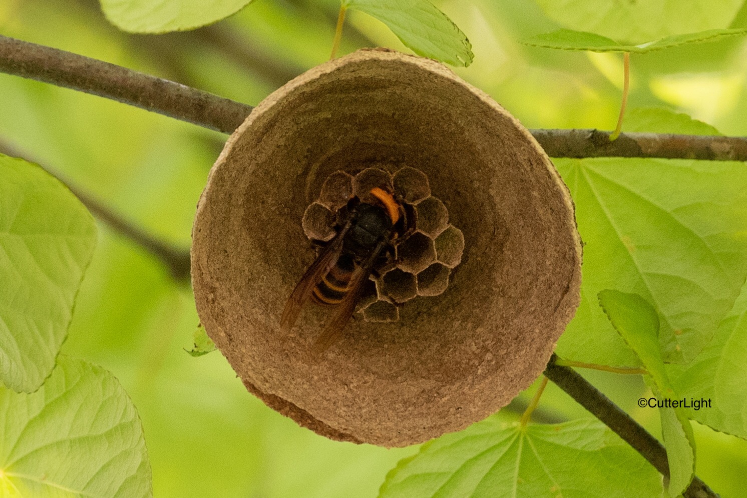
Although the Japanese express great concern regarding the several hundred higuma (brown bears) that inhabit the island, of far greater danger are the huge suzumebachi (Japanese Giant Hornet) which account for a number of deaths each year in Japan. We found this one beginning a nest and uneasily got this capture before backing off.
We enjoyed a wonderful, stress-free stay at the Ana Crowne Hotel in Chitose. Hotel staff were extremely accommodating to our unusual needs – even allowing us to store our large bicycle boxes with them until our return in August.