
It feels very much that when this is finished, America will continue as a democracy, or embark on a far more perilous course.

It feels very much that when this is finished, America will continue as a democracy, or embark on a far more perilous course.

I’ve enjoyed going back through photographs from our four years in Arctic Alaska. Although there are a number of additional pictures I’m reasonably happy with, the truth is that most of the images we made in those years constitute memories rather than art. As self-taught photographers, we still had a lot to learn about light, and how cameras interpret light, and composition, and optimal camera settings, lens choices and technique. Moreover, the images we made in those early days have a somewhat random feel about them as we hadn’t yet developed a vision for how we wanted to shoot and what we wanted to make images of… what stories we wanted to tell. We’d love to go back and revisit those scenes, and from time to time we discuss the possibility… but as Frost warned, way leads to way.
When we left Point Hope in the spring of 2014, we traveled to Mongolia where we lived for the following two years. We’re looking forward now to revisiting that collection. So, we hope to see you “in Mongolia!” JD


Saltwater inundation caused by an encroaching sea forced the people of Point Hope to relocate further inland down Tikigaq Peninsula a few decades ago, but I am told that as recently as the 1970’s a few people still inhabited homes such as the one above. In fact, on at least one such structure we saw, there was a junction box for electricity. Along with these igloos (a term which refers not just to structures made of ice, but to any dome-shaped Inupiat dwelling), there were other more familiar-looking homes in old Tikigaq, but those too have long been abandoned to decay back into the Arctic tundra.
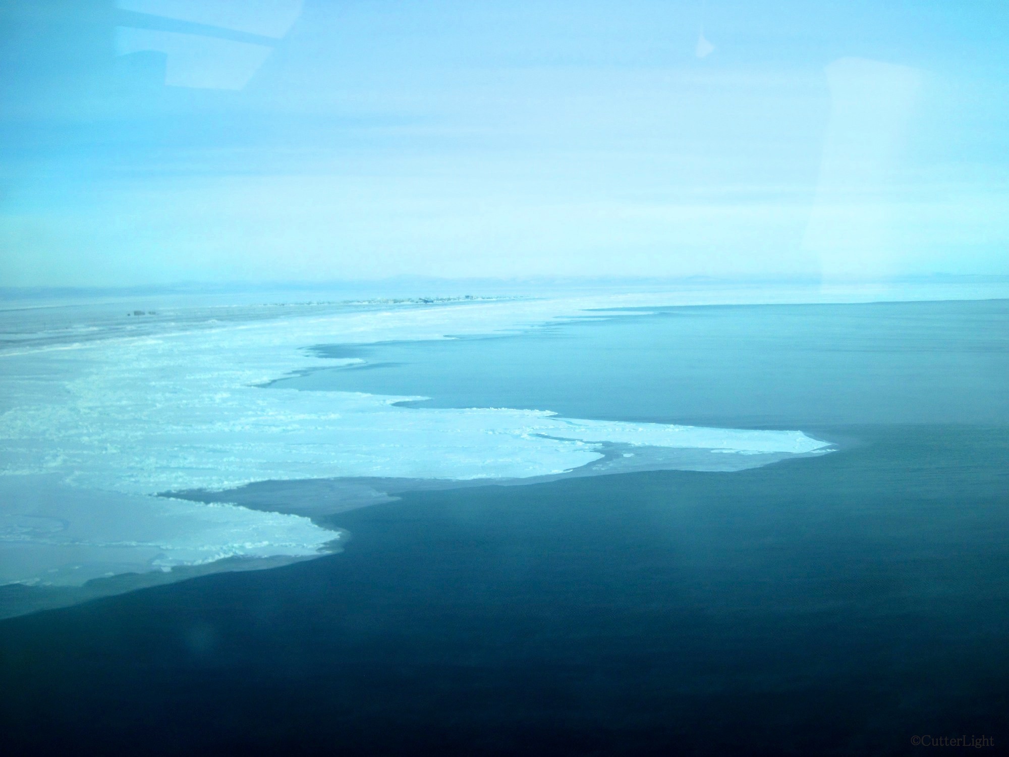
Sea ice fascinates us. Our village can be seen in the upper left of this photo. At the time of the photo, north winds had blown much of the ice away from the land. The “sticky ice,” the ice which clings to the shore, can usually be relied on to be safe to walk on. Even this sticky ice is subject to the whim of Mother Nature’s strong winds and current.
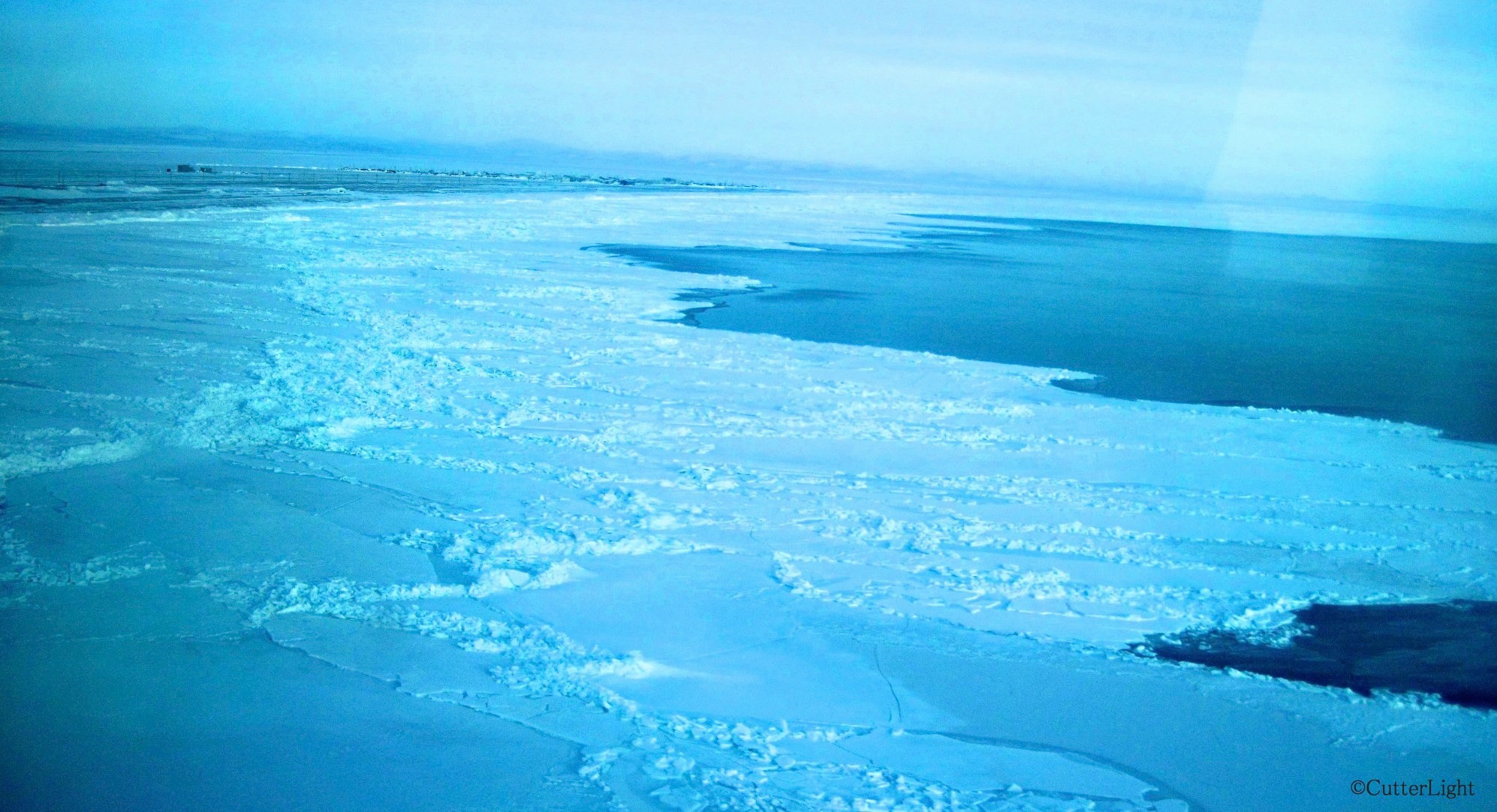
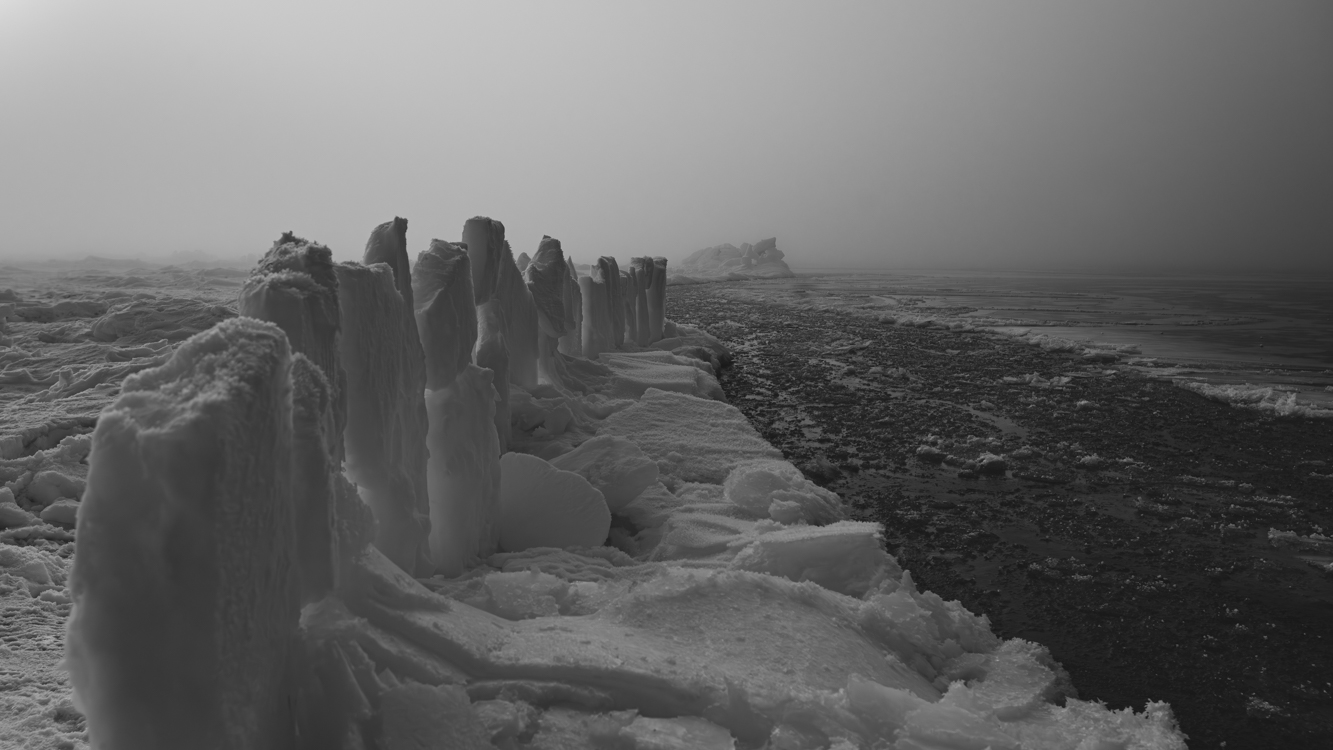
Piles of ice form along pressure points of the frozen surface of the sea. There are many histories of boats navigating too late in the season and becoming stranded or crushed between these pressure points.

Recently, wind from the south has closed this lead – the open water to the right. The view from our village today is solid ice as far as the eye can see. The villagers are readying their seal skin boats to go whaling. Soon the bowhead migration will begin. When the north wind blows open a lead, the whaling crews of Tikigaq will patrol the open water in hopes of catching animals that are in their Spring migrations. These whales make up a critical part of the subsistence catch in this Inupiat village.
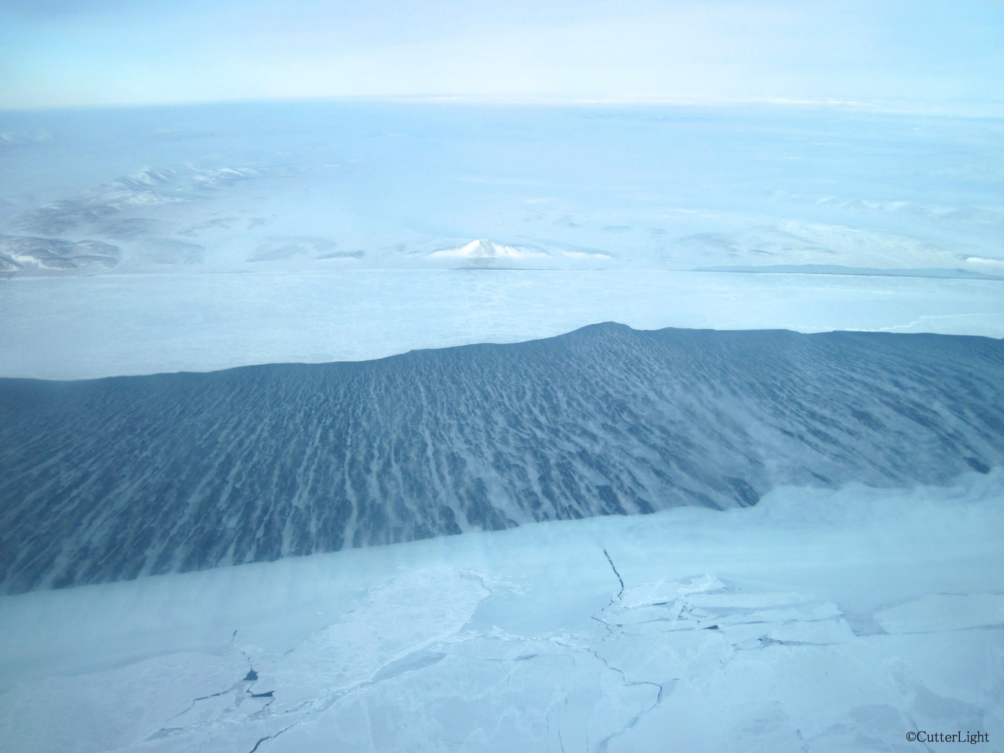
I’ve recently been reading the book The Firecracker Boys. This true story is about a crazy post WWII idea some engineers and scientists had for using a nuclear bomb to blast a harbor between the peak in the center of this photo and the ridge on the left. This is about 25 miles east of Point Hope. The proposed H-bomb was to be 163 times the strength of the bomb that was dropped on Hiroshima. Scientists and engineers promised to sculpt the land based on human requirements. It was part marketing (using bombs for good) and part wild scientific experimentation. It’s a shocking and crazy true story!
Nose pressed to glass, I peered out from the bush plane window as we lifted straight up, like a helicopter, in the 40 m.p.h. north wind. It seemed scary on the ground. With gusts well above 40 m.p.h., the plane arrived, landed on the airstrip and never turned into the usual parking area. I fought my way toward the plane, slipping along the airstrip as if being pushed down by a strong arm. Once in the plane, I felt calm and safe with skilled bush pilots at the controls.

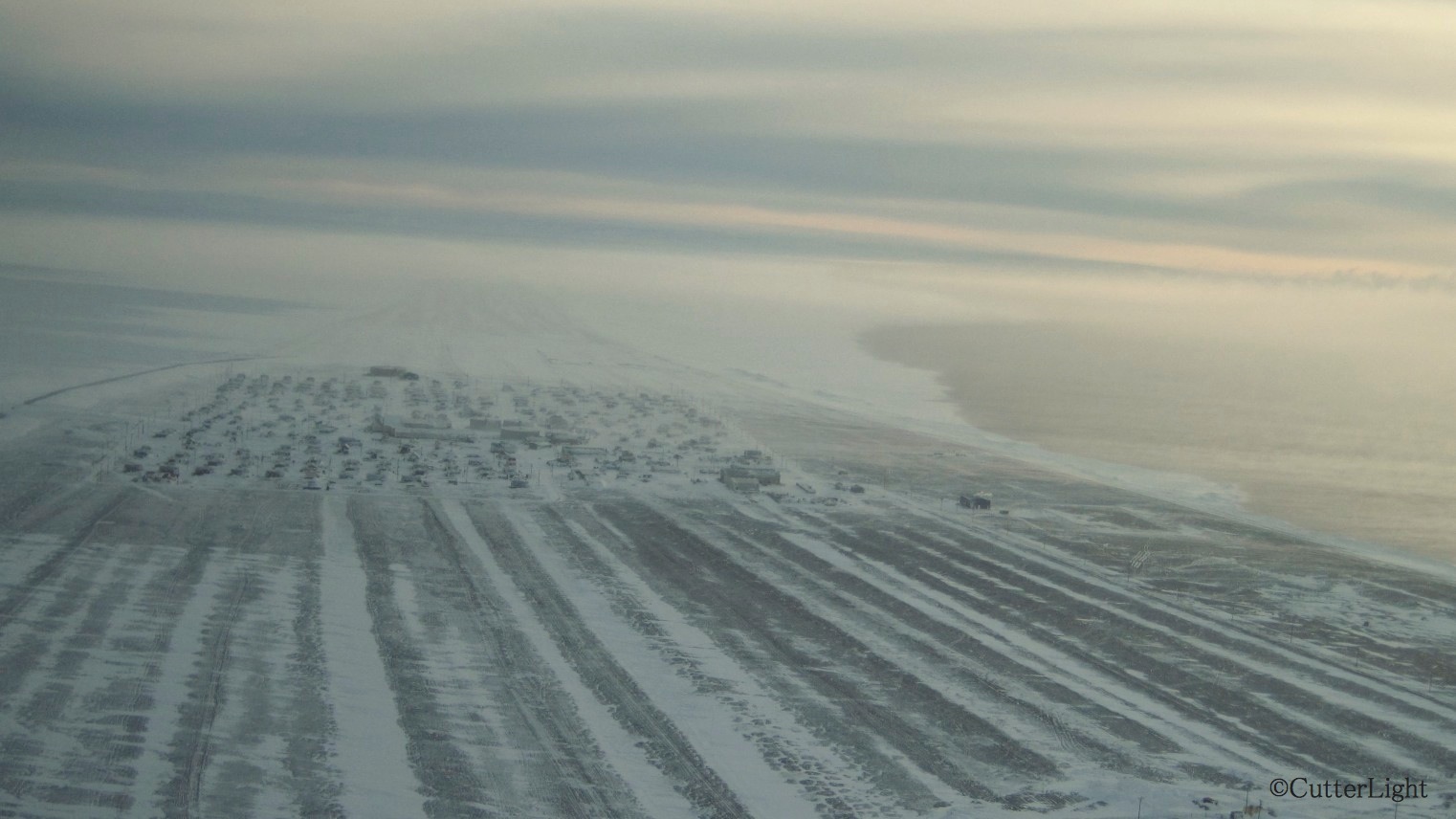
From the air, the village looks like a patchwork quilt as rooftops peak above a blanket of snow. If the snow and ice were sand, Point Hope could be any beachfront real estate in the world!
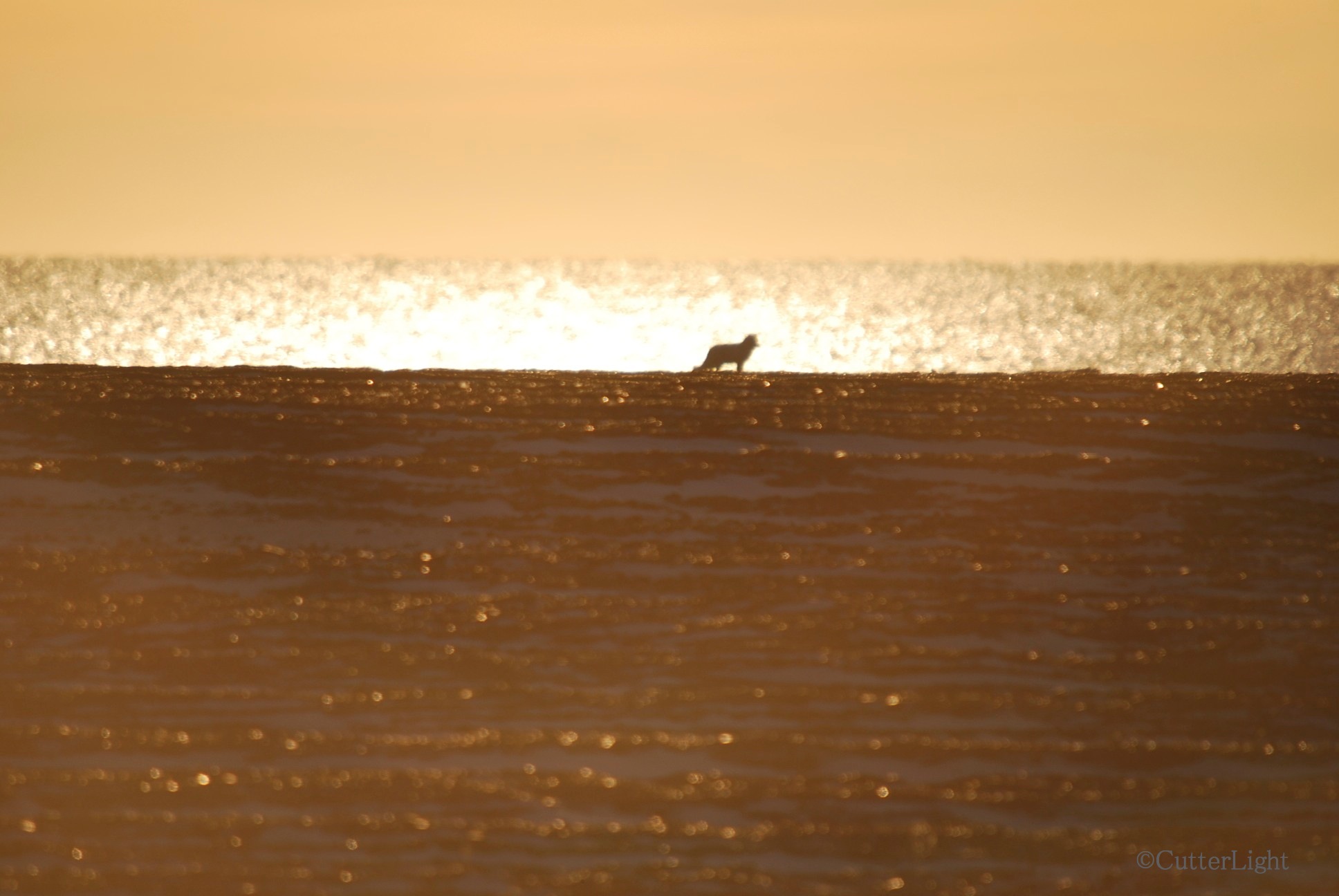
Point Hope, Alaska, along the south beach: An Arctic fox is silhouetted in the gold of a late fall sunset.
On Wednesday, December 5, the sun will rise at 1:37 pm. It will climb for just 19 minutes and 30 seconds before it begins to descend. At 2:16, it will sink beneath the ice-sheeted sea. It will not rise above the horizon again for 28 days. During this time, afternoon twilight will be the extent of our natural light. Cold and darkness will clamp down hard on our village. The Arctic winds this time of year can make a well-built house shudder.
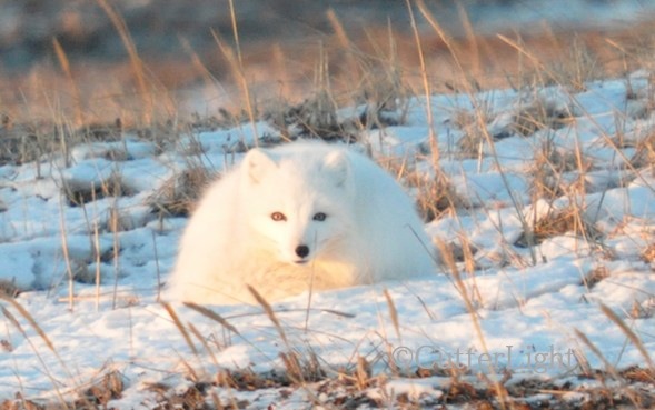
The photo above and the next two are of an Arctic fox we found hanging around the deserted Old Town site of Tikigaq a mile or so west of Point Hope three weeks ago. They’re intelligent, inquisitive animals and will sometimes approach quite close.
In mid fall, foxes and snowy owls show up in numbers near the village. They patrol the beach for fish and whatever else may have washed up and they hunt the tundra for voles and squirrels. As the days grow short and the real cold sets in, they scatter.

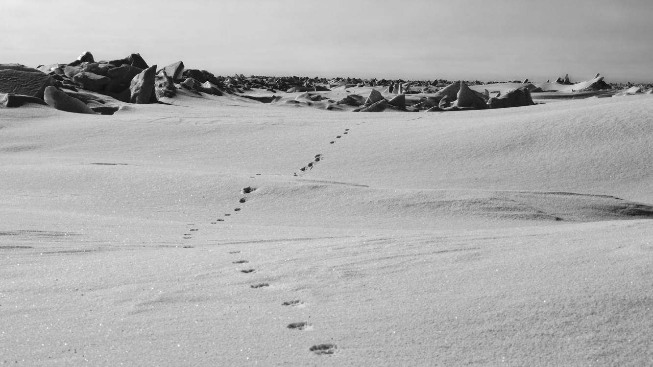
This one is very likely out on the sea ice now, scavenging the remains of seals killed by polar bears. These foxes often travel vast distances during the course of a winter in search of food.

Caribou have moved down from the hills, and sometimes we see them now out on the tundra a few miles east of town. Wolves follow the caribou, and a few hardy ravens manage to scratch out a living throughout the winter. Every so often, we see a flock of murres – seabirds – heading out in search of open water.
