Tikigaq Sky with Horned Puffins and Thick-billed Murres

Looking out across the Chukchi Sea from the very tip of Tikigaq Peninsula.
Near Point Hope, Alaska, August 12, 2012.

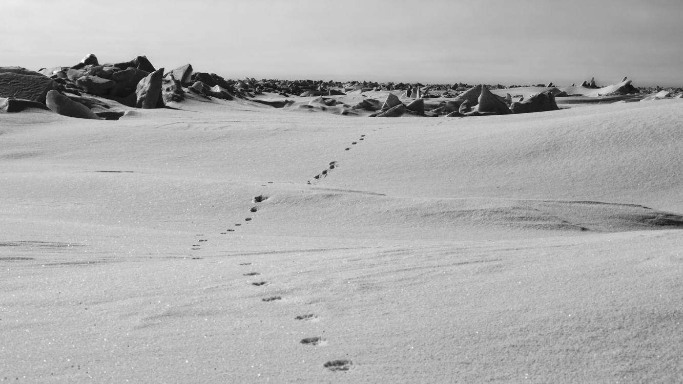
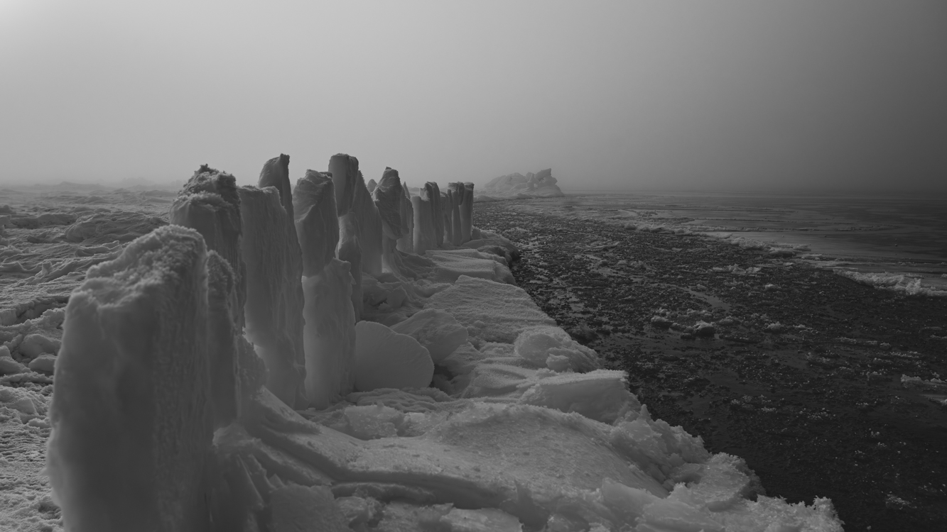
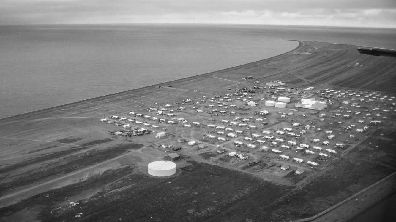
It was a two-and-a-half mile walk from our home in Point Hope to the terminal point of Tikigaq Peninsula where it hooked into the Chukchi Sea. Cape Lisburne lay to the north; other rocky sea cliffs lay to the southeast. Dense colonies of seabirds – murres, puffins, various ducks, gulls and other birds – nested in these natural sanctuaries, and if you stood at the tip of the peninsula you could watch the adult birds fly back and forth all day long in the summer, in one direct bills and bellies empty, on the return their bellies crammed full of food and what they couldn’t fit in their bellies hanging from their bills. Sand Lances and other fish to be presented to nesting mates and offspring. It was a difficult hike out, a good bit of it along a pebbled beach. At that time in our lives we hadn’t yet made a study of wildflowers, but they were abundant and brightened the path. And you never new when you might come across an Arctic Fox, a Snowy Owl or something else of interest.

Hiking for any distance along a sand beach becomes work, and If you’ve ever walked far along a pebbled beach you know that pebbles make for an even more arduous hike. The ocean breeze was almost always cold at that latitude above the Arctic Circle.

Wishing at times to travel light, we did not always take camera gear.

Which was, of course, a mistake.

One morning in early fall, we arrived at the point and – not knowing what we were in for – found ourselves looking out at more birds than we had ever in our lives seen. Quite probably, more than we will ever see again. Wave upon wave of puffins, murres, kittiwakes, shearwaters and I don’t know what else were streaming out from the cliffs and capes, chicks fledged, the season over. Most of these seabirds would not return to land again until the following spring when they would begin a new nesting season. We had seen films depicting African migrations of wildebeests and other ungulates, and in Alaska of great herds of caribou, and those films were called to mind. I once, in Kentucky, found myself amidst a late spring migration of Box Turtles; I pulled my car to the shoulder and assisted over a dozen of them safely across the country road I was traveling. If I had that to do over, I’d have stayed for as long as it took and helped more…

Surely that morning on the tip of Tikigaq, Barbra and I were witness to one of the world’s greatest migration events. We felt, suddenly, a deep connection with… something… overwhelming. Thoreau’s contact, or a final couplet from Wordsworth:

To me the meanest flower that blooms can give
Thoughts that lie too deep for tears.

Tracks

Polar Bear tracks disappear into the other worldly landscape of ice and snow on the frozen Chukchi Sea near Point Hope. The great bears continuously roam the ice in search of seals and the remains of whales that have been caught. By average weight, Polar Bears rank as the world’s largest bear. However, the Coastal Brown Bears of Kodiak Island and the Chignik River drainage on the Alaska Peninsula can weigh as much and stand taller. April 26, 2012

Sentinel

Engraved with a cross and reaching into the sky, the jawbone of a Bowhead Whale stands sentinel over a grave buried in spring snow at Point Hope, Alaska. April 12, 2012

Umiak Artist

Artist and boatwright Henry “Hanko” Koonook at work on an umiak in his shop. The keel, thwarts and each wooden rib is hand fashioned and precisely fitted. When the frame is finished, it will be covered with the stretched skin of an ugruk (bearded seal). This will be the boat’s hull. Traditional skin boats such as these are still used by Inupiat whaling crews in Point Hope and other villages of the far north. Long may it be so. Point Hope, Alaska, March 21, 2013.

Igloo: Arctic Home made of Whale Bone, Ship Timbers & Sod

Ghost village ruins of an Inupiat home constructed from ship timbers, sod and the bones of Bowhead Whales. Tikigaq, Alaska September 3, 2011

Saltwater inundation caused by an encroaching sea forced the people of Point Hope to relocate further inland down Tikigaq Peninsula a few decades ago, but I am told that as recently as the 1970’s a few people still inhabited homes such as the one above. In fact, on at least one such structure we saw, there was a junction box for electricity. Along with these igloos (a term which refers not just to structures made of ice, but to any dome-shaped Inupiat dwelling), there were other more familiar-looking homes in old Tikigaq, but those too have long been abandoned to decay back into the Arctic tundra.

Icehenge

Black and white photograph of a hunting blind made of large ice slabs positioned along the edge of Arctic sea ice by Inupiat whalers.
Three miles out on the frozen Chukchi Sea, 125 miles north of the Arctic Circle, thick fog lifts to reveal slabs of ice positioned by Inupiat whalers to serve as a hunting blind along the edge of a slushy lead. Both Bowhead and Beluga Whales are taken as they migrate through these open lanes between sheets of ice. Near Point Hope. Alaska, May 3, 2012

The Catch: Bringing a Whale up on Sea Ice in Arctic Alaska

Inupiat whaling on the frozen Chukchi Sea near Point Hope, Alaska. April 26, 2012

As Bowhead Whales go, this was a small one – perhaps 10 tons or so. We had hiked approximately three miles from the village of Point Hope across the frozen Chukchi Sea to the camp where we had heard a whale had been caught. Locals had traveled by snowmachine and honda (snowmobile and ATV). There is always the danger of encountering a Polar Bear in this environment, and so we were armed. After snapping this picture I handed the camera to Barbra and took a place on the rope.

The open water in this picture is called a lead – an opening between two sheets of ice. You can see, across the water, the jumble of ice along the edge. Sea ice is often not the smooth sheet of white one might imagine. It continuously buckles, pushes up along pressure ridges, drifts apart and then presses back together. In a way, it behaves like the Earth’s tectonic plates, buckling, heaving, colliding, lifting. And so in order to make a whaling camp, trails must first be made through these places where jagged ridges of ice, individual chunks the size of cars, some much larger, must be broken through and smoothed out.

It is a lot of work to take a whale.

The Bones of Tikigaq: Whaling Festival Site, Point Hope, Alaska

The Bones of Tikigaq
Whaling Festival Site, Point Hope, Alaska. The larger bones presented as arches are the jawbones of Bowhead Whales. Traditionally, the skull is returned to the sea so that the whale’s spirit is properly released. Point Hope, Alaska, August 12, 2012

Point Hope, Alaska from the Air

Our first view of Point Hope, Alaska – 125 miles north of the Arctic Circle (August 1, 2011)

Modern-day Point Hope is located on a narrow peninsula hooking into the Chukchi Sea. In the not-so-distant past, the village was further out on the peninsula, but erosion caused by an encroaching sea has wiped away a good bit of the peninsula, and the old village, called Tikigaq (which means index finger – for the peninsula’s shape), was relocated further inland due to seawater inundation. With evidence of habitation going back at least nine thousand years, Tikigaq Peninsula is regarded as one of the very oldest continuously inhabited sites in North America.

The very essence of an Alaskan bush village is its isolation and remoteness. The only road leading out of Point Hope, Seven Mile Road, ends abruptly a good bit less then seven miles: 250 miles from Barrow, 572 miles to Fairbanks, 694 miles from Anchorage. Thus Point Hope exists as a neatly lain out grid of homes and other buildings surrounded on two sides by water and on one by the vast Arctic tundra. Polar Bears and Arctic Foxes are regular visitors. To experience life in a place so thoroughly separated from the rest of the world is perspective changing – and in an unexpected way, exhilarating.

Large ocean-going barges freight in everything from the school bus – which keeps children safe from both frostbite and Polar Bears – to heavy equipment and building supplies; planes bring in smaller items, including groceries and mail. Hunting and gathering provide a great deal of additional food. This subsistence take includes Bowhead and Beluga whale meat and blubber, caribou, ducks, geese, ptarmigan, salmon, char and grayling along with cloudberries (Rubus chamaemorus) a few blueberries and in some families, seaweeds.

Photographs in coming days will show more of the village and perhaps lend some insight into life there. Thanks for reading.

Dog Sled Races, Shishmaref, Alaska

Black and white photograph of an unknown musher and his team dog sledding during a race in Shishmaref, Alaska.
A number of families kept teams of dogs, and during the wintertime holidays there were dog sled races. These were short races of perhaps a few miles. The speed and skill demonstrated was incredible. December 27, 2010